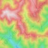
Geolokaliseren

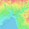
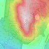
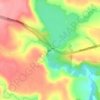
Topografische kaart Western Port

Klik op de kaart om de hoogte weer te geven.

Western Port

Formerly a major river drainage system, it was inundated together with Port Phillip by the rising sea in the Holocene period; the Western Port sunkland now forms an extensive tidal bay. The waters of Western Port cover an area of 680 km² of which 270 km² are exposed as mud flats at low tide. The topography of Western Port is dominated by two large islands: French Island and Phillip Island. The coastline, including that of the islands, is some 263 km. The bay and its islands are criss-crossed by seven seismically active fault lines and experiences numerous minor earthquakes every year.

Wikipedia (CC-BY-SA 3.0)

Over deze kaart

Naam: Topografische kaart Western Port, hoogte, reliëf.

Locatie: Western Port, Victoria, 3923, Australia (-38.55089 145.02535 -38.21378 145.55248)

Gemiddelde hoogte: 35 m

Minimale hoogte: -1 m

Maximale hoogte: 298 m

Andere topografische kaarten

Klik op een kaart om zijn topografie, zijn hoogte en zijn reliëf te bekijken.
Ballarat

Australia > Victoria

Ballarat has a moderate oceanic climate (Köppen climate classification Cfb) with four distinct seasons. Its elevation, ranging between 400 and 630 metres (1,310 and 2,070 feet) above sea level, causes its mean monthly temperatures to tend to be on average 3 to 5 °C (5 to 9 °F) below those of Melbourne,…

Gemiddelde hoogte: 470 m
Geelong

Australia > Victoria

Gemiddelde hoogte: 42 m

Kinglake

Australia > Victoria > Kinglake

Gemiddelde hoogte: 416 m

Melbourne

Australia > Victoria

Melbourne is also prone to isolated convective showers forming when a cold pool crosses the state, especially if there is considerable daytime heating. These showers are often heavy and can include hail, squalls, and significant drops in temperature, but they often pass through very quickly with a rapid…

Gemiddelde hoogte: 49 m

Leongatha

Australia > Victoria > Leongatha

Gemiddelde hoogte: 70 m

Allans Flat

Australia > Victoria

Gemiddelde hoogte: 223 m

Stony Creek

Australia > Victoria

Gemiddelde hoogte: 48 m

Toolangi

Australia > Victoria

Gemiddelde hoogte: 460 m

Springs

Australia > Victoria

Gemiddelde hoogte: 2 m

Gisborne

Australia > Victoria > Gisborne

Gemiddelde hoogte: 457 m

Mount Macedon

Australia > Victoria

Gemiddelde hoogte: 755 m

Diamond Creek

Australia > Victoria

Gemiddelde hoogte: 75 m

Riddells Creek

Australia > Victoria

Gemiddelde hoogte: 450 m

Ballarat

Australia > Victoria

Ballarat has a moderate oceanic climate (Köppen climate classification Cfb) with four distinct seasons. Its elevation, ranging between 400 and 630 metres (1,310 and 2,070 feet) above sea level, causes its mean monthly temperatures to tend to be on average 3 to 5 °C (5 to 9 °F) below those of Melbourne,…

Gemiddelde hoogte: 470 m
Mount Bogong

Australia > Victoria

The Big River separates the massif of the mountain from the Bogong High Plains to the south. From the nearby town of Mount Beauty to its summit, Mount Bogong rises more than 1,600 metres (5,200 ft), thus making it one of the highest peaks in Australia not only in terms of its elevation above sea level, but…

Gemiddelde hoogte: 1.719 m

Fairpark Reserve

Australia > Victoria > Melbourne > Bayswater

Gemiddelde hoogte: 100 m

Mount Howitt

Australia > Victoria

Gemiddelde hoogte: 1.467 m

Cheshunt

Australia > Victoria

Gemiddelde hoogte: 304 m

Marcus Hill

Australia > Victoria

Gemiddelde hoogte: 40 m

Metung

Australia > Victoria

Gemiddelde hoogte: 9 m
Rokewood

Australia > Victoria

Gemiddelde hoogte: 191 m
Mooroopna

Australia > Victoria

Gemiddelde hoogte: 114 m
Woorndoo

Australia > Victoria

Gemiddelde hoogte: 204 m

Sugar Loaf Hill

Australia > Victoria

Gemiddelde hoogte: 359 m

Maryborough

Australia > Victoria > Maryborough

Gemiddelde hoogte: 240 m

Euroa

Australia > Victoria

Gemiddelde hoogte: 200 m

Broadford

Australia > Victoria

Gemiddelde hoogte: 253 m

Colac

Australia > Victoria > Colac

Gemiddelde hoogte: 141 m

Clear Spot Lookout

Australia > Victoria

Gemiddelde hoogte: 718 m

Shepparton

Australia > Victoria

Gemiddelde hoogte: 116 m

Happy Valley

Australia > Victoria

Gemiddelde hoogte: 65 m

Sandy Point

Australia > Victoria

Gemiddelde hoogte: 4 m

Mount Moornapa

Australia > Victoria

Gemiddelde hoogte: 312 m

Nagambie

Australia > Victoria

Gemiddelde hoogte: 131 m

Meeniyan

Australia > Victoria

Gemiddelde hoogte: 40 m

Toke Gibbo

Australia > Victoria

Gemiddelde hoogte: 1.054 m

Black Rock

Australia > Victoria > Wedderburn

Gemiddelde hoogte: 201 m

Port Albert

Australia > Victoria

Gemiddelde hoogte: 2 m

Loch Sport

Australia > Victoria

Gemiddelde hoogte: 2 m

Dandenong

Australia > Victoria > Dandenong

Gemiddelde hoogte: 36 m

Nunniong Plains

Australia > Victoria

Gemiddelde hoogte: 1.218 m

Wye River

Australia > Victoria

Gemiddelde hoogte: 325 m

Bayview

Australia > Victoria

Gemiddelde hoogte: 150 m

Warrnambool

Australia > Victoria

Gemiddelde hoogte: 28 m

Glenlyon

Australia > Victoria

Gemiddelde hoogte: 561 m

Mount Barambogie

Australia > Victoria

Gemiddelde hoogte: 411 m

Everton

Australia > Victoria

Gemiddelde hoogte: 198 m

Mount Baw Baw

Australia > Victoria

Gemiddelde hoogte: 1.422 m

Yea

Australia > Victoria

Gemiddelde hoogte: 214 m

Seymour

Australia > Victoria

Gemiddelde hoogte: 156 m

Bendigo

Australia > Victoria

Gemiddelde hoogte: 223 m

Tolmie

Australia > Victoria

Gemiddelde hoogte: 830 m

Ballan

Australia > Victoria

Gemiddelde hoogte: 505 m

Gordon

Australia > Victoria

Gemiddelde hoogte: 580 m

Mount Beauty

Australia > Victoria

Gemiddelde hoogte: 564 m

Korumburra

Australia > Victoria > Korumburra

Gemiddelde hoogte: 210 m

Greendale

Australia > Victoria

Gemiddelde hoogte: 497 m

Merri Creek

Australia > Victoria

Gemiddelde hoogte: 300 m

Bonnie Doon

Australia > Victoria

Gemiddelde hoogte: 331 m

Strathbogie

Australia > Victoria

Gemiddelde hoogte: 508 m

Lal Lal

Australia > Victoria

Gemiddelde hoogte: 468 m

Congupna

Australia > Victoria

Gemiddelde hoogte: 110 m

Point Patterson

Australia > Victoria

Gemiddelde hoogte: 195 m

Dartmouth Dam

Australia > Victoria

Gemiddelde hoogte: 560 m

Mays Hill

Australia > Victoria

Gemiddelde hoogte: 139 m

Rosebery

Australia > Victoria

Gemiddelde hoogte: 83 m

East Framlingham

Australia > Victoria

Gemiddelde hoogte: 108 m

Mount Buggery

Australia > Victoria

Gemiddelde hoogte: 1.286 m

Pykes Creek Dam

Australia > Victoria

Gemiddelde hoogte: 425 m

Mount Reynard

Australia > Victoria

Gemiddelde hoogte: 1.573 m

Wilhelmina Falls

Australia > Victoria

Gemiddelde hoogte: 509 m

Mount William

Australia > Victoria

Gemiddelde hoogte: 614 m

Bells Beach

Australia > Victoria

Gemiddelde hoogte: 27 m

Mount Delegate

Australia > Victoria

Gemiddelde hoogte: 1.016 m

Sandy Creek

Australia > Victoria

Gemiddelde hoogte: 399 m

Mount Glasgow

Australia > Victoria

Gemiddelde hoogte: 300 m

Rawson

Australia > Victoria

Gemiddelde hoogte: 414 m

Campbells Creek

Australia > Victoria

Gemiddelde hoogte: 299 m

Torrumbarry

Australia > Victoria

Gemiddelde hoogte: 89 m

Bolinda

Australia > Victoria

Gemiddelde hoogte: 377 m

Arbuckle Junction

Australia > Victoria

Gemiddelde hoogte: 1.401 m

City of Wodonga

Australia > Victoria

Gemiddelde hoogte: 246 m

Castlemaine

Australia > Victoria

The Castlemaine goldfields' legendary prosperity raised expectations of Castlemaine becoming Victoria's second city. That is reflected in imposing buildings erected in the town's first few years. Though the rich alluvial diggings were largely exhausted within 15-20 years causing the town's population to shrink…

Gemiddelde hoogte: 331 m
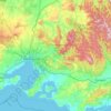
Yarra Valley

Australia > Victoria > Melbourne

The Yarra Valley is the region surrounding the Yarra River in Victoria, Australia. The river originates approximately 240 km (150 mi) east of the Melbourne central business district and flows towards it and out into Port Phillip Bay. The name Yarra Valley is used in reference to the upper regions surrounding…

Gemiddelde hoogte: 305 m
Lake Glenmaggie

Australia > Victoria

Gemiddelde hoogte: 98 m

Tallarook

Australia > Victoria

Gemiddelde hoogte: 202 m

Hollands Landing

Australia > Victoria

Gemiddelde hoogte: 1 m

Merrigum

Australia > Victoria

Gemiddelde hoogte: 110 m

Mount Oberon

Australia > Victoria

Gemiddelde hoogte: 184 m

Toombullup

Australia > Victoria

Gemiddelde hoogte: 855 m

Wentworth River

Australia > Victoria

Gemiddelde hoogte: 301 m

Mount Noorat

Australia > Victoria

Mount Noorat is a major volcano of the Newer Volcanics Province of Victoria, with a peak height of 310 metres above sea level and a crater between 160 and 200 metres. It is characterised by multiple vents, a complex topography, and the deepest scoria enclosed crater in Victoria. The mount illustrates a…

Gemiddelde hoogte: 176 m

Buenba Creek

Australia > Victoria

Gemiddelde hoogte: 1.006 m

Noojee

Australia > Victoria

Gemiddelde hoogte: 334 m

Hotham Village

Australia > Victoria

Gemiddelde hoogte: 1.585 m

Nelson

Australia > Victoria

Gemiddelde hoogte: 11 m

Yallourn North

Australia > Victoria

Gemiddelde hoogte: 99 m

Low Head

Australia > Victoria

Gemiddelde hoogte: 205 m

Rust jezelf uit voor je volgende avontuur:

🛰️Hand-GPS Toestellen - Nauwkeurige navigatie voor de meest afgelegen plekken
🗺️Fysieke Kaarten België - De perfecte aanvulling op digitale topografie
📘Outdoor Handleidingen - Praktische kennis voor avonturiers
🧭Expeditie Uitrusting - Voor veeleisende outdoor avonturen
🥾Wandelschoenen Heren - Comfortabele en duurzame wandelschoenen voor elk terrein

Als Amazon-partner verdient deze site een commissie op in aanmerking komende aankopen, zonder extra kosten voor jou.