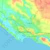
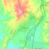
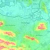
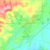
Topografische kaart Broadford
Klik op de kaart om de hoogte weer te geven.
Over deze kaart

Naam: Topografische kaart Broadford, hoogte, reliëf.
Locatie: Broadford, Shire of Mitchell, Victoria, 3658, Australia (-37.24199 145.01040 -37.16199 145.09040)
Gemiddelde hoogte: 253 m
Minimale hoogte: 183 m
Maximale hoogte: 442 m
Andere topografische kaarten
Klik op een kaart om zijn topografie, zijn hoogte en zijn reliëf te bekijken.
City of Melbourne
Melbourne's topography is characterized by a diverse landscape that transitions from flat coastal plains to rolling hills and mountainous regions. The city is situated at the northern end of Port Phillip Bay, where the terrain is predominantly flat, facilitating urban development. As one moves eastward, the…
Gemiddelde hoogte: 18 m
Melbourne
Melbourne is also prone to isolated convective showers forming when a cold pool crosses the state, especially if there is considerable daytime heating. These showers are often heavy and can include hail, squalls, and significant drops in temperature, but they often pass through very quickly with a rapid…
Gemiddelde hoogte: 185 m



Lancefield
Lancefield's elevation and climate made it a popular summer resort in the 1880s. In recent years, many local wineries have been established in the area.
Gemiddelde hoogte: 530 m

King River
The King River rises below Mount Buggery, within Mansfield Shire, at an elevation exceeding 1,460 metres (4,790 ft) above sea level. The river flows generally north by northwest, most of its course through remote parts of the Alpine and Mount Buffalo national parks, and then descending into the King Valley,…
Gemiddelde hoogte: 467 m
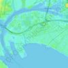

Templestowe
Australia > Victoria > Melbourne
Gentle, rolling hills extend from east of the Yarra River flood plains, along Templestowe Road (towards the Eastern Freeway) for seven km (4.3 miles), to the north-east. The altitude of the plain above sea level is 50 m, and the topography is subdued and mostly flat; the hills are just below 60 m, the slopes…
Gemiddelde hoogte: 66 m
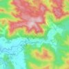

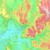
Yarra Ranges National Park
Australia > Victoria > Lake Mountain Alpine Resort
Gemiddelde hoogte: 465 m
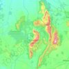
Grampians National Park
Mount William is known within the gliding community for the "Grampians Wave", a weather phenomenon that sometimes enables glider pilots to reach extreme altitudes of the order of 28,000 ft (8,500 m). This predominantly occurs during the months of May, June, September and October when strong westerly winds flow…
Gemiddelde hoogte: 262 m

Castlemaine
The Castlemaine goldfields' legendary prosperity raised expectations of Castlemaine becoming Victoria's second city. That is reflected in imposing buildings erected in the town's first few years. Though the rich alluvial diggings were largely exhausted within 15–20 years causing the town's population to…
Gemiddelde hoogte: 319 m