Geolokaliseren

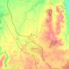
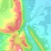
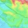
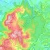
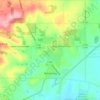
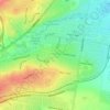
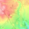
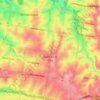
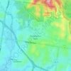
Topografische kaart Rawson

Klik op de kaart om de hoogte weer te geven.

Over deze kaart

Naam: Topografische kaart Rawson, hoogte, reliëf.

Locatie: Rawson, Shire of Baw Baw, Victoria, Australia (-37.97682 146.37967 -37.93682 146.41967)

Gemiddelde hoogte: 414 m

Minimale hoogte: 199 m

Maximale hoogte: 541 m

Andere topografische kaarten

Klik op een kaart om zijn topografie, zijn hoogte en zijn reliëf te bekijken.
City of Melbourne

Australia > Victoria

Melbourne's topography is characterized by a diverse landscape that transitions from flat coastal plains to rolling hills and mountainous regions. The city is situated at the northern end of Port Phillip Bay, where the terrain is predominantly flat, facilitating urban development. As one moves eastward, the…

Gemiddelde hoogte: 18 m
Melbourne

Australia > Victoria

Melbourne is also prone to isolated convective showers forming when a cold pool crosses the state, especially if there is considerable daytime heating. These showers are often heavy and can include hail, squalls, and significant drops in temperature, but they often pass through very quickly with a rapid…

Gemiddelde hoogte: 185 m
Melbourne

Australia > Victoria

Melbourne is also prone to isolated convective showers forming when a cold pool crosses the state, especially if there is considerable daytime heating. These showers are often heavy and can include hail, squalls, and significant drops in temperature, but they often pass through very quickly with a rapid…

Gemiddelde hoogte: 185 m

Torquay

Australia > Victoria

Gemiddelde hoogte: 32 m

Wantirna

Australia > Victoria > Melbourne

Gemiddelde hoogte: 95 m

Kyneton

Australia > Victoria

Gemiddelde hoogte: 504 m

Sandringham District

Australia > Victoria > Melbourne

Gemiddelde hoogte: 24 m

Sorrento

Australia > Victoria

Gemiddelde hoogte: 9 m

Ivanhoe District

Australia > Victoria > Melbourne

Gemiddelde hoogte: 54 m

Gippsland

Australia > Victoria

Gemiddelde hoogte: 273 m

Shire of Macedon Ranges

Australia > Victoria

Gemiddelde hoogte: 464 m

St Andrews Beach

Australia > Victoria > Melbourne

St Andrews Beach features a unique topography known as The Cups Country, which creates an ideal environment for golf courses. Golfers have a choice of several nearby golf courses including the St Andrews Beach Club on Sandy Road, Moonah Links off Truemans Road, and The Dunes on Browns Road.

Gemiddelde hoogte: 10 m

Ferny Creek

Australia > Victoria

Gemiddelde hoogte: 134 m

Phillip Island

Australia > Victoria > Ventnor

Gemiddelde hoogte: 5 m

Harrietville

Australia > Victoria

Gemiddelde hoogte: 1.018 m

Halls Gap

Australia > Victoria

Gemiddelde hoogte: 406 m

Greenvale

Australia > Victoria

Gemiddelde hoogte: 163 m

Ascot Vale

Australia > Victoria

Gemiddelde hoogte: 19 m

Port Phillip

Australia > Victoria

Port Phillip's mostly flat topography and moderate waves make perfect conditions for recreational swimming, kitesurfing, windsurfing, sailing, boating, snorkeling, scuba diving, stand up paddle boarding (SUP) and other sports.

Gemiddelde hoogte: 18 m

Brighton

Australia > Victoria > Melbourne

Gemiddelde hoogte: 13 m

Red Hill

Australia > Victoria

Gemiddelde hoogte: 140 m

Langwarrin

Australia > Victoria > Melbourne

Gemiddelde hoogte: 71 m

Grampians National Park

Australia > Victoria

Mount William is known within the gliding community for the "Grampians Wave", a weather phenomenon that sometimes enables glider pilots to reach extreme altitudes of the order of 28,000 ft (8,500 m). This predominantly occurs during the months of May, June, September and October when strong westerly winds flow…

Gemiddelde hoogte: 262 m

Merricks

Australia > Victoria

Gemiddelde hoogte: 51 m

South Yarra

Australia > Victoria

Gemiddelde hoogte: 19 m

Bentleigh East

Australia > Victoria > Melbourne

Gemiddelde hoogte: 50 m

Upwey

Australia > Victoria > Belgrave

Gemiddelde hoogte: 214 m

Camberwell

Australia > Victoria > Melbourne

The Prospect Hill Road Precinct area is adjacent to the railway station and is the oldest part of the suburb. The original subdivision was relatively generous blocks, which were quickly filled with fine Victorian and Edwardian houses. Due to its hilly topography, many east–west streets in the Prospect Hill…

Gemiddelde hoogte: 66 m

Footscray

Australia > Victoria > Melbourne

Gemiddelde hoogte: 19 m

Ringwood North

Australia > Victoria > Melbourne

Gemiddelde hoogte: 138 m

Mount Evelyn

Australia > Victoria

Gemiddelde hoogte: 189 m

Towong Upper

Australia > Victoria

Gemiddelde hoogte: 429 m

West Melbourne

Australia > Victoria

Gemiddelde hoogte: 8 m

Aspendale

Australia > Victoria

Gemiddelde hoogte: 4 m

Olinda

Australia > Victoria

Gemiddelde hoogte: 370 m

Croydon

Australia > Victoria

Gemiddelde hoogte: 125 m

Grampians

Australia > Victoria

Gemiddelde hoogte: 151 m

Glen Waverley

Australia > Victoria

Gemiddelde hoogte: 103 m

Mirboo North

Australia > Victoria

Gemiddelde hoogte: 216 m

South Morang

Australia > Victoria

Gemiddelde hoogte: 153 m

Bass Coast Shire

Australia > Victoria

Gemiddelde hoogte: 45 m

Woodend

Australia > Victoria

Gemiddelde hoogte: 603 m

Morwell

Australia > Victoria

Gemiddelde hoogte: 61 m

Shire of Pyrenees

Australia > Victoria

Gemiddelde hoogte: 334 m

Romsey

Australia > Victoria

Gemiddelde hoogte: 506 m

Kevington

Australia > Victoria

Gemiddelde hoogte: 579 m

Chiltern

Australia > Victoria

Gemiddelde hoogte: 284 m

Lake Wendouree

Australia > Victoria > Ballarat

Gemiddelde hoogte: 452 m

Blackwood

Australia > Victoria

Gemiddelde hoogte: 644 m

Christmas Hills

Australia > Victoria

Gemiddelde hoogte: 148 m

Balliang

Australia > Victoria

Gemiddelde hoogte: 193 m

Clayton

Australia > Victoria > Melbourne

Gemiddelde hoogte: 79 m

Anglesea

Australia > Victoria

Gemiddelde hoogte: 60 m

Frankston South

Australia > Victoria

Gemiddelde hoogte: 84 m

Balnarring

Australia > Victoria

Gemiddelde hoogte: 59 m

Frankston

Australia > Victoria

Olivers Hill is the most prominent elevation in Frankston which rises to 55 metres above sea level (180 feet) at its highest point in the suburb. Its origins date to approximately 415 to 360 million years ago. Its base is Mount Eliza Granite dating from the Devonian period, which was covered in lava tuffs in…

Gemiddelde hoogte: 40 m
Great Otway National Park

Australia > Victoria

Gemiddelde hoogte: 91 m

Highton

Australia > Victoria > Geelong

Gemiddelde hoogte: 52 m

Wonga

Australia > Victoria

Gemiddelde hoogte: 220 m

McCrae

Australia > Victoria

Gemiddelde hoogte: 89 m

Grovedale

Australia > Victoria > Geelong

Gemiddelde hoogte: 34 m

Lerderderg State Park

Australia > Victoria > Melbourne

Gemiddelde hoogte: 459 m

Carrajung

Australia > Victoria

Gemiddelde hoogte: 390 m

Cape Woolamai

Australia > Victoria

Gemiddelde hoogte: 6 m

High Camp

Australia > Victoria

Gemiddelde hoogte: 378 m

Howqua River

Australia > Victoria

Gemiddelde hoogte: 773 m

Wimbledon Heights

Australia > Victoria

Gemiddelde hoogte: 41 m

East Melbourne

Australia > Victoria > Melbourne

Gemiddelde hoogte: 24 m

Flinders

Australia > Victoria

Gemiddelde hoogte: 53 m

Wye River

Australia > Victoria

Gemiddelde hoogte: 325 m

Wodonga

Australia > Victoria

Gemiddelde hoogte: 191 m

Cobungra

Australia > Victoria

Gemiddelde hoogte: 1.124 m

Springs

Australia > Victoria

Gemiddelde hoogte: 2 m

Maribyrnong

Australia > Victoria > Melbourne

Gemiddelde hoogte: 23 m

Hazelwood North

Australia > Victoria

Gemiddelde hoogte: 119 m

Mordialloc

Australia > Victoria

Gemiddelde hoogte: 10 m

Sunbury

Australia > Victoria

Gemiddelde hoogte: 275 m

Lorne

Australia > Victoria

Gemiddelde hoogte: 161 m

Lakes Entrance

Australia > Victoria

Gemiddelde hoogte: 39 m

Surrey Hills

Australia > Victoria

Gemiddelde hoogte: 96 m

Diamond Creek

Australia > Victoria

Gemiddelde hoogte: 75 m

Traralgon

Australia > Victoria

Gemiddelde hoogte: 53 m

Wollert

Australia > Victoria

Gemiddelde hoogte: 191 m

Riddells Creek

Australia > Victoria

Gemiddelde hoogte: 450 m

Omeo

Australia > Victoria

There are bus routes from Bright and Bairnsdale. The Bairnsdale bus runs weekdays, once both directions, and the Bright bus (Alps Link) timetable is less frequent in Summer and runs additional services during the ski season. Alps Link is the highest altitude public bus in Australia. The town sits at the…

Gemiddelde hoogte: 861 m
Warburton

Australia > Victoria

Gemiddelde hoogte: 525 m

Doncaster East

Australia > Victoria

Gemiddelde hoogte: 89 m

Kallista

Australia > Victoria

Gemiddelde hoogte: 319 m

Moonee Ponds

Australia > Victoria > Melbourne > Moonee Ponds

Gemiddelde hoogte: 30 m

Beaconsfield Upper

Australia > Victoria

Gemiddelde hoogte: 153 m

Merri Creek

Australia > Victoria

Gemiddelde hoogte: 300 m

Botanic Ridge

Australia > Victoria

Gemiddelde hoogte: 72 m

Healesville

Australia > Victoria

Gemiddelde hoogte: 232 m

Endeavour Hills

Australia > Victoria

Gemiddelde hoogte: 68 m

Dartmouth Dam

Australia > Victoria

Gemiddelde hoogte: 560 m

Loch Sport

Australia > Victoria > Loch Sport

Gemiddelde hoogte: 6 m

Marlo

Australia > Victoria

Gemiddelde hoogte: 55 m

Rust jezelf uit voor je volgende avontuur:

🧴Handgel - Hygiëne zonder stromend water
🧥Regenjassen Dames - Stijlvolle en functionele regenkleding voor wandelaars
🩹EHBO-sets - Compacte eerste hulp voor wandelaars en fietsers
📱GPS Apps Wandelen - Digitale navigatie voor smartphones
🧭Kompassen - Essentieel voor navigatie met topografische kaarten

Als Amazon-partner verdient deze site een commissie op in aanmerking komende aankopen, zonder extra kosten voor jou.