Geolokaliseren

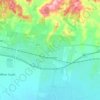
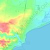
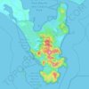
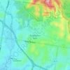
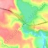
Topografische kaart Bayview

Klik op de kaart om de hoogte weer te geven.

Over deze kaart

Naam: Topografische kaart Bayview, hoogte, reliëf.

Locatie: Bayview, Surf Coast Shire, Victoria, Australia (-38.16047 144.20399 -38.16037 144.20409)

Gemiddelde hoogte: 150 m

Minimale hoogte: 32 m

Maximale hoogte: 212 m

Andere topografische kaarten

Klik op een kaart om zijn topografie, zijn hoogte en zijn reliëf te bekijken.
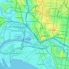
City of Melbourne

Australia > Victoria

Melbourne's topography is characterized by a diverse landscape that transitions from flat coastal plains to rolling hills and mountainous regions. The city is situated at the northern end of Port Phillip Bay, where the terrain is predominantly flat, facilitating urban development. As one moves eastward, the…

Gemiddelde hoogte: 18 m
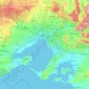
Melbourne

Australia > Victoria

Melbourne is also prone to isolated convective showers forming when a cold pool crosses the state, especially if there is considerable daytime heating. These showers are often heavy and can include hail, squalls, and significant drops in temperature, but they often pass through very quickly with a rapid…

Gemiddelde hoogte: 185 m

Melbourne

Australia > Victoria

Melbourne is also prone to isolated convective showers forming when a cold pool crosses the state, especially if there is considerable daytime heating. These showers are often heavy and can include hail, squalls, and significant drops in temperature, but they often pass through very quickly with a rapid…

Gemiddelde hoogte: 189 m
Grampians National Park

Australia > Victoria

Mount William is known within the gliding community for the "Grampians Wave", a weather phenomenon that sometimes enables glider pilots to reach extreme altitudes of the order of 28,000 ft (8,500 m). This predominantly occurs during the months of May, June, September and October when strong westerly winds flow…

Gemiddelde hoogte: 262 m

Wantirna

Australia > Victoria > Melbourne

Gemiddelde hoogte: 95 m

Pakenham

Australia > Victoria > Melbourne

Gemiddelde hoogte: 56 m

Blairgowrie

Australia > Victoria

Gemiddelde hoogte: 7 m

Great Otway National Park

Australia > Victoria

Gemiddelde hoogte: 91 m

Clayton

Australia > Victoria > Melbourne

Gemiddelde hoogte: 79 m

Doreen

Australia > Victoria

Gemiddelde hoogte: 159 m

Port Phillip

Australia > Victoria

Port Phillip's mostly flat topography and moderate waves make perfect conditions for recreational swimming, kitesurfing, windsurfing, sailing, boating, snorkeling, scuba diving, stand up paddle boarding (SUP) and other sports.

Gemiddelde hoogte: 18 m
Echuca

Australia > Victoria

Gemiddelde hoogte: 100 m

Stanhope

Australia > Victoria

Gemiddelde hoogte: 108 m

Balliang

Australia > Victoria

Gemiddelde hoogte: 193 m

Mordialloc

Australia > Victoria

Gemiddelde hoogte: 10 m

McCrae

Australia > Victoria

Gemiddelde hoogte: 89 m

Ensay

Australia > Victoria

Gemiddelde hoogte: 416 m

Mount Lonarch

Australia > Victoria

Gemiddelde hoogte: 428 m

Phillip Island

Australia > Victoria > Ventnor

Gemiddelde hoogte: 5 m

Wodonga

Australia > Victoria

Gemiddelde hoogte: 191 m

Burwood East

Australia > Victoria > Melbourne

Gemiddelde hoogte: 117 m

Balliang East

Australia > Victoria

Gemiddelde hoogte: 128 m

Tullamarine

Australia > Victoria > Melbourne

Gemiddelde hoogte: 90 m

Halls Gap

Australia > Victoria

Gemiddelde hoogte: 406 m

Toorak

Australia > Victoria > Melbourne

Gemiddelde hoogte: 33 m

Walhalla

Australia > Victoria

Gemiddelde hoogte: 426 m

Plenty River

Australia > Victoria > Melbourne

Gemiddelde hoogte: 214 m

Swan Hill

Australia > Victoria

Gemiddelde hoogte: 72 m

Riddells Creek

Australia > Victoria

Gemiddelde hoogte: 450 m

Mount Martha

Australia > Victoria

Gemiddelde hoogte: 40 m

Caulfield District

Australia > Victoria

Gemiddelde hoogte: 35 m

Doncaster East

Australia > Victoria

Gemiddelde hoogte: 89 m

Bright

Australia > Victoria

Gemiddelde hoogte: 550 m

Mildura

Australia > Victoria

Gemiddelde hoogte: 47 m

Hernes Oak

Australia > Victoria

Gemiddelde hoogte: 128 m

Shire of Mansfield

Australia > Victoria

Gemiddelde hoogte: 748 m

Wangaratta

Australia > Victoria

Gemiddelde hoogte: 148 m

Lake Wellington

Australia > Victoria

Gemiddelde hoogte: 3 m

Amphitheatre

Australia > Victoria

Gemiddelde hoogte: 373 m

Lake Eildon

Australia > Victoria

Gemiddelde hoogte: 386 m

Tawonga

Australia > Victoria

Gemiddelde hoogte: 372 m

Mansfield

Australia > Victoria

Gemiddelde hoogte: 401 m

Smythesdale

Australia > Victoria

Gemiddelde hoogte: 399 m

Skipton

Australia > Victoria

Gemiddelde hoogte: 300 m

Diamond Creek

Australia > Victoria

Gemiddelde hoogte: 75 m

Greensborough

Australia > Victoria

Gemiddelde hoogte: 83 m

Omeo

Australia > Victoria

There are bus routes from Bright and Bairnsdale. The Bairnsdale bus runs weekdays, once both directions, and the Bright bus (Alps Link) timetable is less frequent in Summer and runs additional services during the ski season. Alps Link is the highest altitude public bus in Australia. The town sits at the…

Gemiddelde hoogte: 861 m
Carlton

Australia > Victoria > Melbourne

Gemiddelde hoogte: 39 m

Torquay

Australia > Victoria

Gemiddelde hoogte: 32 m

Mount Eliza

Australia > Victoria > Melbourne

Gemiddelde hoogte: 60 m

Mirboo North

Australia > Victoria

Gemiddelde hoogte: 216 m

Dartmouth Dam

Australia > Victoria

Gemiddelde hoogte: 560 m

Ocean Grove

Australia > Victoria

Gemiddelde hoogte: 23 m

Flowerdale

Australia > Victoria

Gemiddelde hoogte: 402 m

Flinders

Australia > Victoria

Gemiddelde hoogte: 53 m

Wye River

Australia > Victoria

Gemiddelde hoogte: 325 m

Porepunkah

Australia > Victoria

Gemiddelde hoogte: 473 m

Hazelwood North

Australia > Victoria

Gemiddelde hoogte: 119 m

Point Cook

Australia > Victoria

Gemiddelde hoogte: 8 m

Olinda

Australia > Victoria

Gemiddelde hoogte: 370 m

Ferny Creek

Australia > Victoria

Gemiddelde hoogte: 134 m

Wheelers Hill

Australia > Victoria

Gemiddelde hoogte: 85 m

Lakes Entrance

Australia > Victoria

Gemiddelde hoogte: 39 m

Castlemaine

Australia > Victoria

The Castlemaine goldfields' legendary prosperity raised expectations of Castlemaine becoming Victoria's second city. That is reflected in imposing buildings erected in the town's first few years. Though the rich alluvial diggings were largely exhausted within 15–20 years causing the town's population to…

Gemiddelde hoogte: 319 m

Horsham

Australia > Victoria

Horsham's topography is flat, approximately 128 metres (420 ft) above sea level. The central business district (CBD) is laid out in a grid plan south of the train line and is characterised by wide streets and several roundabouts. Firebrace Street, running north–south through the middle of the CBD is one of…

Gemiddelde hoogte: 129 m

Glen Iris

Australia > Victoria

Gemiddelde hoogte: 46 m

Mornington District

Australia > Victoria > Melbourne

Gemiddelde hoogte: 50 m

Anglesea

Australia > Victoria

Gemiddelde hoogte: 60 m

Wollert

Australia > Victoria

Gemiddelde hoogte: 191 m

Kangaroo Flat

Australia > Victoria

Gemiddelde hoogte: 282 m

Clyde North

Australia > Victoria

Gemiddelde hoogte: 38 m

Mooroolbark

Australia > Victoria > Montrose

Gemiddelde hoogte: 130 m

Clifton Hill

Australia > Victoria

Gemiddelde hoogte: 32 m

Docklands

Australia > Victoria

Gemiddelde hoogte: 9 m

Warburton

Australia > Victoria

Gemiddelde hoogte: 525 m

Mount Evelyn

Australia > Victoria

Gemiddelde hoogte: 189 m

Merri Creek

Australia > Victoria

Gemiddelde hoogte: 300 m

Daylesford

Australia > Victoria

Gemiddelde hoogte: 587 m

Gippsland

Australia > Victoria

Gemiddelde hoogte: 273 m

Garfield North

Australia > Victoria > Melbourne

Gemiddelde hoogte: 137 m

Frankston

Australia > Victoria

Olivers Hill is the most prominent elevation in Frankston which rises to 55 metres above sea level (180 feet) at its highest point in the suburb. Its origins date to approximately 415 to 360 million years ago. Its base is Mount Eliza Granite dating from the Devonian period, which was covered in lava tuffs in…

Gemiddelde hoogte: 40 m

Lysterfield Park

Australia > Victoria > Melbourne

Gemiddelde hoogte: 114 m

Creswick

Australia > Victoria

Gemiddelde hoogte: 469 m

Botanic Ridge

Australia > Victoria

Gemiddelde hoogte: 72 m

Endeavour Hills

Australia > Victoria

Gemiddelde hoogte: 68 m

HMAS Cerberus

Australia > Victoria > Melbourne

Gemiddelde hoogte: 10 m

Pykes Creek Dam

Australia > Victoria

Gemiddelde hoogte: 425 m

Myrtleford

Australia > Victoria

Gemiddelde hoogte: 330 m

Macleay Park

Australia > Victoria

Gemiddelde hoogte: 57 m

Macedon

Australia > Victoria

Newspaper articles from the late 19th and early 20th century describe the wide variety of plants that flourished at the State Nursery in spite of its poor topsoil and craggy terrain. Cool-climate trees like cypress, larch, cedar and pine thrived at the high altitude; deciduous species of oak, ash and birch…

Gemiddelde hoogte: 542 m

Kevington

Australia > Victoria

Gemiddelde hoogte: 579 m

Matlock

Australia > Victoria

Gemiddelde hoogte: 889 m

Paynesville

Australia > Victoria > Paynesville

Gemiddelde hoogte: 8 m

Flora Hill

Australia > Victoria > Bendigo

Gemiddelde hoogte: 261 m

Rust jezelf uit voor je volgende avontuur:

⌚Outdoor GPS Horloges - Multifunctionele GPS-horloges voor wandelen en trail
🔌Reisadapters - Voor de grensstreken en internationale trips
🛠️Fiets Multitools - Voer onderweg kleine reparaties uit
🪵Aanmaakblokjes - Start veilig een vuur op toegestane plekken
🎒Dagrugzakken - Compacte rugzakken voor korte wandelingen

Als Amazon-partner verdient deze site een commissie op in aanmerking komende aankopen, zonder extra kosten voor jou.