Geolokaliseren

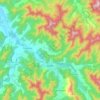
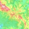
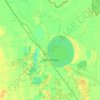
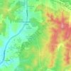
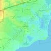
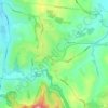
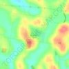
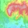
Topografische kaart Stanley

Klik op de kaart om de hoogte weer te geven.

Over deze kaart

Naam: Topografische kaart Stanley, hoogte, reliëf.

Locatie: Stanley, Shire of Indigo, Victoria, Australia (-36.42489 146.73485 -36.38489 146.77485)

Gemiddelde hoogte: 756 m

Minimale hoogte: 657 m

Maximale hoogte: 894 m

Andere topografische kaarten

Klik op een kaart om zijn topografie, zijn hoogte en zijn reliëf te bekijken.
City of Melbourne

Australia > Victoria

Melbourne's topography is characterized by a diverse landscape that transitions from flat coastal plains to rolling hills and mountainous regions. The city is situated at the northern end of Port Phillip Bay, where the terrain is predominantly flat, facilitating urban development. As one moves eastward, the…

Gemiddelde hoogte: 18 m
Melbourne

Australia > Victoria

Melbourne is also prone to isolated convective showers forming when a cold pool crosses the state, especially if there is considerable daytime heating. These showers are often heavy and can include hail, squalls, and significant drops in temperature, but they often pass through very quickly with a rapid…

Gemiddelde hoogte: 185 m
Melbourne

Australia > Victoria

Melbourne is also prone to isolated convective showers forming when a cold pool crosses the state, especially if there is considerable daytime heating. These showers are often heavy and can include hail, squalls, and significant drops in temperature, but they often pass through very quickly with a rapid…

Gemiddelde hoogte: 185 m

Grampians National Park

Australia > Victoria

Mount William is known within the gliding community for the "Grampians Wave", a weather phenomenon that sometimes enables glider pilots to reach extreme altitudes of the order of 28,000 ft (8,500 m). This predominantly occurs during the months of May, June, September and October when strong westerly winds flow…

Gemiddelde hoogte: 262 m
Mount Eliza

Australia > Victoria > Melbourne

Gemiddelde hoogte: 60 m

Rosebud

Australia > Victoria > Melbourne

Gemiddelde hoogte: 44 m

Bright

Australia > Victoria

Gemiddelde hoogte: 550 m

Baranduda

Australia > Victoria

Gemiddelde hoogte: 235 m

Skye

Australia > Victoria

Gemiddelde hoogte: 35 m

Kew

Australia > Victoria > Melbourne

Gemiddelde hoogte: 38 m

Warburton

Australia > Victoria

Gemiddelde hoogte: 525 m

Creswick

Australia > Victoria

Gemiddelde hoogte: 469 m

Emerald

Australia > Victoria > Melbourne

Gemiddelde hoogte: 225 m

Mount Martha

Australia > Victoria

Gemiddelde hoogte: 40 m

Sorrento

Australia > Victoria

Gemiddelde hoogte: 9 m

Fitzroy Gardens

Australia > Victoria > Melbourne

Gemiddelde hoogte: 27 m

Albert Park

Australia > Victoria

Heritage Victoria notes that Albert Park's St Vincent Gardens "is historically important as the premier 'square' development in Victoria based on similar models in London. It is significant as the largest development of its type in Victoria and for its unusual development as gardens rather than the more usual…

Gemiddelde hoogte: 6 m

Howqua Hills

Australia > Victoria

Gemiddelde hoogte: 676 m

Yarraville

Australia > Victoria

Gemiddelde hoogte: 17 m

North Melbourne

Australia > Victoria

Gemiddelde hoogte: 24 m

Lorne

Australia > Victoria

Gemiddelde hoogte: 161 m

Castlemaine

Australia > Victoria

The Castlemaine goldfields' legendary prosperity raised expectations of Castlemaine becoming Victoria's second city. That is reflected in imposing buildings erected in the town's first few years. Though the rich alluvial diggings were largely exhausted within 15–20 years causing the town's population to…

Gemiddelde hoogte: 319 m
Halls Gap

Australia > Victoria

Gemiddelde hoogte: 406 m

Wollert

Australia > Victoria

Gemiddelde hoogte: 191 m

Mirboo North

Australia > Victoria

Gemiddelde hoogte: 216 m

Balnarring

Australia > Victoria

Gemiddelde hoogte: 59 m

Apollo Bay

Australia > Victoria

Gemiddelde hoogte: 136 m

Beaconsfield Upper

Australia > Victoria

Gemiddelde hoogte: 153 m

Lake Boga

Australia > Victoria

Gemiddelde hoogte: 72 m

Gippsland

Australia > Victoria

Gemiddelde hoogte: 273 m

Great Otway National Park

Australia > Victoria

Gemiddelde hoogte: 91 m

Axedale

Australia > Victoria

Gemiddelde hoogte: 186 m

Shire of Mansfield

Australia > Victoria

Gemiddelde hoogte: 748 m

Glenaladale

Australia > Victoria

Gemiddelde hoogte: 132 m

City of Greater Bendigo

Australia > Victoria

Gemiddelde hoogte: 200 m

Mitta Mitta

Australia > Victoria

Gemiddelde hoogte: 739 m

Poowong East

Australia > Victoria

Gemiddelde hoogte: 195 m

Paynesville

Australia > Victoria > Paynesville

Gemiddelde hoogte: 8 m

Campbells Creek

Australia > Victoria

Gemiddelde hoogte: 319 m

Cowes

Australia > Victoria

Gemiddelde hoogte: 27 m

Everton

Australia > Victoria

Gemiddelde hoogte: 229 m

Mount Camel

Australia > Victoria

Gemiddelde hoogte: 223 m

Wodonga

Australia > Victoria

Gemiddelde hoogte: 191 m

Porepunkah

Australia > Victoria

Gemiddelde hoogte: 473 m

Vermont South

Australia > Victoria > Melbourne

In 1966 the Metropolitan & Melbourne Board of Works (MMBW) put forth a plan to construct numerous "package" sewage treatment plants in the valleys of Dandenong Creek and its tributaries. The project aimed to provide adequate sewerage to the catchment before the Dandenong Valley Trunk sewer (DVT) could…

Gemiddelde hoogte: 100 m
City of Boroondara

Australia > Victoria

Gemiddelde hoogte: 53 m

Box Hill

Australia > Victoria > Melbourne

Gemiddelde hoogte: 93 m

Wesburn

Australia > Victoria > Melbourne

Gemiddelde hoogte: 362 m

Timbarra

Australia > Victoria

Gemiddelde hoogte: 376 m

Hume

Australia > Victoria

Gemiddelde hoogte: 359 m

Murchison North

Australia > Victoria

Gemiddelde hoogte: 121 m

Point Cook

Australia > Victoria

Gemiddelde hoogte: 8 m

Rowville

Australia > Victoria > Melbourne

Gemiddelde hoogte: 79 m

Collingwood

Australia > Victoria

Collingwood's topography is mostly flat, but a prominent slope extends from Hoddle Street up to Smith Street, and also along sections of Hoddle Street.

Gemiddelde hoogte: 30 m
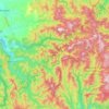
Mount Buller

Australia > Victoria

Due to its far south-western location in the alpine region, Mount Buller is more susceptible to cold airmasses which allow it to record some of the lowest maximum temperatures and daytime readings in the country, despite being considerably lower in elevation than other mountain sites to the north-east. On 5…

Gemiddelde hoogte: 824 m

Ferntree Gully District

Australia > Victoria

Gemiddelde hoogte: 92 m

Elwood

Australia > Victoria > Melbourne

Gemiddelde hoogte: 8 m

Warrnambool

Australia > Victoria

Gemiddelde hoogte: 19 m

Glen Waverley

Australia > Victoria

Gemiddelde hoogte: 103 m

Footscray

Australia > Victoria > Melbourne

Gemiddelde hoogte: 19 m

Caulfield District

Australia > Victoria

Gemiddelde hoogte: 35 m

Toorak

Australia > Victoria > Melbourne

Gemiddelde hoogte: 33 m

Mount Evelyn

Australia > Victoria

Gemiddelde hoogte: 189 m

Frankston

Australia > Victoria > Melbourne

Olivers Hill is the most prominent elevation in Frankston which rises to 55 metres above sea level (180 feet) at its highest point in the suburb. Its origins date to approximately 415 to 360 million years ago. Its base is Mount Eliza Granite dating from the Devonian period, which was covered in lava tuffs in…

Gemiddelde hoogte: 40 m
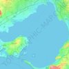
Port Phillip

Australia > Victoria

Port Phillip's mostly flat topography and moderate waves make perfect conditions for recreational swimming, kitesurfing, windsurfing, sailing, boating, snorkeling, scuba diving, stand up paddle boarding (SUP) and other sports.

Gemiddelde hoogte: 18 m
Endeavour Hills

Australia > Victoria

Gemiddelde hoogte: 68 m

Ballarat East

Australia > Victoria

Gemiddelde hoogte: 477 m

Portland

Australia > Victoria

Gemiddelde hoogte: 20 m

Heathcote

Australia > Victoria

Gemiddelde hoogte: 252 m

Shepparton

Australia > Victoria

Gemiddelde hoogte: 114 m

Shire of South Gippsland

Australia > Victoria

Gemiddelde hoogte: 81 m

Port Fairy

Australia > Victoria

Gemiddelde hoogte: 22 m

Safety Beach

Australia > Victoria > Melbourne

Gemiddelde hoogte: 23 m

Lardner Park

Australia > Victoria

Gemiddelde hoogte: 125 m

Coronet Bay

Australia > Victoria

Gemiddelde hoogte: 13 m

Noradjuha

Australia > Victoria

Gemiddelde hoogte: 150 m

Eppalock

Australia > Victoria

Gemiddelde hoogte: 214 m

Phillip Island

Australia > Victoria > Ventnor

Gemiddelde hoogte: 5 m

City of Greater Shepparton

Australia > Victoria

Gemiddelde hoogte: 128 m

Ryanston

Australia > Victoria

Gemiddelde hoogte: 118 m

Clarkefield

Australia > Victoria

Gemiddelde hoogte: 298 m

Lara

Australia > Victoria

Gemiddelde hoogte: 25 m

Panton Hill

Australia > Victoria

Gemiddelde hoogte: 147 m

Bullengarook

Australia > Victoria

Gemiddelde hoogte: 526 m

Lerderderg State Park

Australia > Victoria > Melbourne

Gemiddelde hoogte: 459 m

King Valley

Australia > Victoria

The King Valley has a history which includes bushrangers, Chinese and Italian immigration. The Chinese migrants came from the Goldfields in the mid-19th century and began careers as market gardeners, tobacco growers and merchants. Many roads in the Valley today carry the names of the more prominent families…

Gemiddelde hoogte: 295 m

Western Port

Australia > Victoria

Formerly a major river drainage system, it was inundated together with Port Phillip by the rising sea in the Holocene period; the Western Port sunkland now forms an extensive tidal bay. The waters of Western Port cover an area of 680 km² of which 270 km² are exposed as mud flats at low tide. The topography…

Gemiddelde hoogte: 35 m

Lucas

Australia > Victoria

Gemiddelde hoogte: 435 m

Acheron

Australia > Victoria

Gemiddelde hoogte: 250 m

Noble Park North

Australia > Victoria

Gemiddelde hoogte: 64 m

Sunshine North

Australia > Victoria

Gemiddelde hoogte: 47 m

Benambra

Australia > Victoria

Benambra town centre is at the intersection of Gibbo Street and Limestone Road, at an altitude of approximately 700m. The town has a population of around 150, although most residents live on farms and properties out of the actual town.

Gemiddelde hoogte: 926 m

Shire of Murrindindi

Australia > Victoria

Gemiddelde hoogte: 447 m

Mount Macedon

Australia > Victoria

Due to its relatively high elevation of approximately 620 metres (2,030 ft) AHD, the area experiences much cooler temperatures on average relative to nearby Melbourne. The area also receives high rainfall relative to the surrounding plains and much of the Melbourne area. This combination of geographic factors…

Gemiddelde hoogte: 673 m
Newport Lakes Reserve

Australia > Victoria > Melbourne

Gemiddelde hoogte: 15 m

Kinglake

Australia > Victoria

Gemiddelde hoogte: 361 m

Smythesdale

Australia > Victoria

Gemiddelde hoogte: 399 m

City of Stonnington

Australia > Victoria

Gemiddelde hoogte: 40 m

Rust jezelf uit voor je volgende avontuur:

🧰Outdoor Multitools - Compacte tools voor elke situatie
🗺️Reliefkaarten - Fysieke kaarten met hoogteverschillen
📢Noodfluitjes - Word gehoord in geval van nood
🧴Handgel - Hygiëne zonder stromend water
🐕Hondenharnassen - Neem je hond mee op je topografische avonturen

Als Amazon-partner verdient deze site een commissie op in aanmerking komende aankopen, zonder extra kosten voor jou.