Geolokaliseren

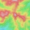
Topografische kaart Timbarra

Klik op de kaart om de hoogte weer te geven.

Over deze kaart

Naam: Topografische kaart Timbarra, hoogte, reliëf.

Locatie: Timbarra, Tenterfield Shire Council, New South Wales, 2372, Australia (-29.14368 152.16097 -28.98149 152.29704)

Gemiddelde hoogte: 810 m

Minimale hoogte: 335 m

Maximale hoogte: 1.123 m

Andere topografische kaarten

Klik op een kaart om zijn topografie, zijn hoogte en zijn reliëf te bekijken.

Blue Mountains

Australia > New South Wales

Gemiddelde hoogte: 723 m

Sydney

Australia > New South Wales

Phillip had been given no instructions for urban development, but in July 1788 submitted a plan for the new town at Sydney Cove. It included a wide central avenue, a permanent Government House, law courts, hospital and other public buildings, but no provision for warehouses, shops, or other commercial…

Gemiddelde hoogte: 32 m

Mount Jagungal

Australia > New South Wales

Gemiddelde hoogte: 1.818 m

Mount Kościuszko

Australia > New South Wales

Mount Kosciuszko is the highest summit in mainland Australia. Until 1977 it was possible to drive from Charlotte Pass to within a few metres of the summit, but in 1977 the road was closed to public motor vehicle access due to environmental concerns. The road is open from Charlotte Pass for walkers and cyclists…

Gemiddelde hoogte: 2.035 m
Tweed Heads

Australia > New South Wales

Gemiddelde hoogte: 3 m

Queanbeyan

Australia > New South Wales

Gemiddelde hoogte: 716 m

Albury

Australia > New South Wales

Gemiddelde hoogte: 246 m

Snowy Mountains

Australia > New South Wales

Gemiddelde hoogte: 2.011 m

Tamworth

Australia > New South Wales

Gemiddelde hoogte: 489 m

Ourimbah Creek

Australia > New South Wales

Gemiddelde hoogte: 131 m

Blue Mountains

Australia > New South Wales

A sandstone plateau dominated by a landscape of endless eucalyptus forests, the Blue Mountains are located at the top of a 470-million-year-old quartzite. In the Permian period, a shallow sea covered the region, when rivers brought shales, siltstones and mudstones. Then during the Mesozoic period, rivers…

Gemiddelde hoogte: 566 m

Tilligerry Creek

Australia > New South Wales

Gemiddelde hoogte: 3 m

Racecourse Creek

Australia > New South Wales

Gemiddelde hoogte: 5 m

Mount Banks

Australia > New South Wales

Mount Banks, otherwise known as Mount King George, is a mountain within the Explorers Range of the Blue Mountains Range that is a spur off the Great Dividing Range, is located within the Blue Mountains National Park, approximately 100 kilometres (62 mi) west of Sydney in New South Wales, Australia. Mount Banks…

Gemiddelde hoogte: 745 m
Vincentia

Australia > New South Wales > Vincentia

Gemiddelde hoogte: 15 m

Jindabyne

Australia > New South Wales > Jindabyne

Gemiddelde hoogte: 983 m

Bemboka

Australia > New South Wales > Bemboka

Gemiddelde hoogte: 212 m

Evans Head

Australia > New South Wales > Evans Head

Gemiddelde hoogte: 6 m

Googong

Australia > New South Wales > Googong

Gemiddelde hoogte: 712 m

Brown Mountain

Australia > New South Wales

Gemiddelde hoogte: 1.160 m

Newcastle

Australia > New South Wales

Gemiddelde hoogte: 9 m

Mount Nardi

Australia > New South Wales

Gemiddelde hoogte: 552 m

Bathurst

Australia > New South Wales

Gemiddelde hoogte: 760 m

Wagga Wagga

Australia > New South Wales

Wagga Wagga has a temperate climate with hot dry summers and cool to cold winters. Under the Köppen climate classification, the city has a humid subtropical climate (Cfa), with a semi-arid influence in its vegetation. At a latitude of 35 degrees and altitude of 212 metres (696 ft), Wagga Wagga has four…

Gemiddelde hoogte: 238 m

Gospers Mountain

Australia > New South Wales

Gemiddelde hoogte: 715 m

Cells Creek

Australia > New South Wales

Gemiddelde hoogte: 820 m

Tuglow

Australia > New South Wales

Gemiddelde hoogte: 1.118 m

Cape Byron

Australia > New South Wales > Byron Bay

Gemiddelde hoogte: 3 m

Wattlegrove

Australia > New South Wales

Gemiddelde hoogte: 93 m

Cooma

Australia > New South Wales > Cooma

Gemiddelde hoogte: 860 m

Grafton

Australia > New South Wales

Gemiddelde hoogte: 36 m

Shooters Hill

Australia > New South Wales

Gemiddelde hoogte: 1.273 m

Badgerys Creek

Australia > New South Wales > Sydney

Gemiddelde hoogte: 88 m

Sussex Inlet

Australia > New South Wales > Sussex Inlet

Gemiddelde hoogte: 10 m

Marulan

Australia > New South Wales > Marulan

Gemiddelde hoogte: 645 m

Woodbury

Australia > New South Wales

Gemiddelde hoogte: 99 m

Dillans Scrub

Australia > New South Wales

Gemiddelde hoogte: 67 m

Louis Point

Australia > New South Wales

Gemiddelde hoogte: 372 m

Australian Alps

Australia > New South Wales

The Australian Alps are a mountain range in southeast Australia. It comprises an interim Australian bioregion, and is the highest mountain range in Australia. The range straddles the borders of eastern Victoria, southeastern New South Wales, and the Australian Capital Territory. It contains Australia's only…

Gemiddelde hoogte: 2.037 m
Maitland

Australia > New South Wales > Maitland

Gemiddelde hoogte: 16 m

Cessnock

Australia > New South Wales

Gemiddelde hoogte: 142 m

Lithgow

Australia > New South Wales

Gemiddelde hoogte: 986 m

Mount Wombat

Australia > New South Wales

Gemiddelde hoogte: 453 m

Little Blue Gum

Australia > New South Wales

Gemiddelde hoogte: 676 m

Eucumbene Cove

Australia > New South Wales

Gemiddelde hoogte: 1.211 m

Katoomba Falls

Australia > New South Wales

Gemiddelde hoogte: 837 m

Mount Borah

Australia > New South Wales

Gemiddelde hoogte: 657 m

Jolly Nose Hill

Australia > New South Wales

Gemiddelde hoogte: 66 m

Mount Narra Narra

Australia > New South Wales

Gemiddelde hoogte: 602 m

King Creek

Australia > New South Wales > Wauchope > King Creek

Gemiddelde hoogte: 6 m

Colo River

Australia > New South Wales

Gemiddelde hoogte: 132 m

Minnamurra River

Australia > New South Wales

Gemiddelde hoogte: 8 m

Clarence River

Australia > New South Wales > Grafton

Gemiddelde hoogte: 4 m

Gundillion

Australia > New South Wales

Gemiddelde hoogte: 765 m

Junction Hill

Australia > New South Wales

Gemiddelde hoogte: 33 m

Danthonia Bruderhof

Australia > New South Wales

Gemiddelde hoogte: 749 m

Wangellic

Australia > New South Wales

Gemiddelde hoogte: 838 m

Foster Mountain

Australia > New South Wales

Gemiddelde hoogte: 732 m

Glenbrook Creek

Australia > New South Wales > Blaxland

Gemiddelde hoogte: 185 m

Towac

Australia > New South Wales

Gemiddelde hoogte: 972 m

Red Cliff Mountain

Australia > New South Wales

Gemiddelde hoogte: 530 m

Towamba River

Australia > New South Wales

Gemiddelde hoogte: 320 m

Clyde River

Australia > New South Wales

Gemiddelde hoogte: 115 m

Freshwater Beach

Australia > New South Wales > Sydney

Gemiddelde hoogte: 11 m

Hunter Valley

Australia > New South Wales

Gemiddelde hoogte: 80 m

Little Murray

Australia > New South Wales

Gemiddelde hoogte: 1.094 m

Mount Yarrahapinni

Australia > New South Wales

Gemiddelde hoogte: 217 m

Pendle Creek

Australia > New South Wales > Sydney

Gemiddelde hoogte: 43 m

Misty Mountain

Australia > New South Wales

Gemiddelde hoogte: 780 m

Liverpool Range

Australia > New South Wales

Gemiddelde hoogte: 475 m

Mount Mitchell

Australia > New South Wales

Gemiddelde hoogte: 1.271 m

Woronora Dam

Australia > New South Wales

The wall of Woronora Dam is an engineering work imbued with a sense of high aesthetic value expressed through the long curved high wall set with the wide valley of the Woronora River. Upstream of the dam wall this setting is characterised by the broad expanse of the pool of water bordered by the crests of the…

Gemiddelde hoogte: 198 m

Cooleman Plain

Australia > New South Wales

Gemiddelde hoogte: 1.290 m

Sydney

Australia > New South Wales

Gemiddelde hoogte: 11 m

Upper Bowman

Australia > New South Wales

Gemiddelde hoogte: 516 m

Curl Curl Beach

Australia > New South Wales > Sydney

Gemiddelde hoogte: 14 m

Maloneys Flat

Australia > New South Wales

Gemiddelde hoogte: 24 m

Cobbin Creek

Australia > New South Wales

Gemiddelde hoogte: 1.011 m

Govetts Leap

Australia > New South Wales

Gemiddelde hoogte: 902 m

Mount Bindo

Australia > New South Wales

Gemiddelde hoogte: 1.184 m

Monaro

Australia > New South Wales > Bredbo

Gemiddelde hoogte: 721 m

Burramoko Ridge

Australia > New South Wales

Gemiddelde hoogte: 920 m

Mount Jingellic

Australia > New South Wales

Gemiddelde hoogte: 696 m

Grove Creek Falls

Australia > New South Wales

Gemiddelde hoogte: 631 m

Middle Bend

Australia > New South Wales

Gemiddelde hoogte: 591 m

Third Creek

Australia > New South Wales

Gemiddelde hoogte: 930 m

Bulldog Diggings

Australia > New South Wales

Gemiddelde hoogte: 667 m

Mount Warning

Australia > New South Wales

Gemiddelde hoogte: 587 m

Wicks Park

Australia > New South Wales > Sydney

Gemiddelde hoogte: 17 m

Young Man Canobolas

Australia > New South Wales

Gemiddelde hoogte: 1.171 m

Mount Clarence

Australia > New South Wales

Gemiddelde hoogte: 999 m

Mount Colong

Australia > New South Wales

Gemiddelde hoogte: 761 m

Lake Victoria

Australia > New South Wales

Gemiddelde hoogte: 33 m

Mount Towac

Australia > New South Wales

Gemiddelde hoogte: 1.182 m

Buchan Point

Australia > New South Wales

Gemiddelde hoogte: 15 m

Empress Falls

Australia > New South Wales

Gemiddelde hoogte: 810 m

Rust jezelf uit voor je volgende avontuur:

🔥Camping Kooktoestellen - Warm eten onderweg tijdens hikes
🏔️Altimeters - Meet nauwkeurig hoogteverschillen tijdens wandelingen
🕶️Outdoor Zonnebrillen - UV-bescherming voor berg en zee
🔋Oplaadbare Batterijen - Power voor je zaklamp of GPS-toestel
🧤Outdoor Accessoires - Onmisbare aanvullingen voor elke hike

Als Amazon-partner verdient deze site een commissie op in aanmerking komende aankopen, zonder extra kosten voor jou.