Geolokaliseren

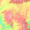
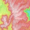
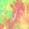
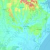
Topografische kaart Mount Borah

Klik op de kaart om de hoogte weer te geven.

Over deze kaart

Naam: Topografische kaart Mount Borah, hoogte, reliëf.

Locatie: Mount Borah, Tamworth Regional Council, New South Wales, Australia (-30.67609 150.60861 -30.67599 150.60871)

Gemiddelde hoogte: 657 m

Minimale hoogte: 474 m

Maximale hoogte: 894 m

Andere topografische kaarten

Klik op een kaart om zijn topografie, zijn hoogte en zijn reliëf te bekijken.
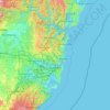
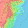
Sydney

Australia > New South Wales

Sydney's topography is characterized by a diverse landscape that seamlessly blends coastal features with inland plateaus. The city is divided into two primary regions: the relatively flat Cumberland Plain to the south and west of Sydney Harbour, and the elevated Hornsby Plateau to the north. The Cumberland…

Gemiddelde hoogte: 51 m
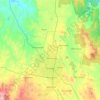
Orange

Australia > New South Wales

Orange is a city in the Central Tablelands region of New South Wales, Australia. It is 254 km (158 mi) west of the state capital, Sydney [206 km (128 mi) on a great circle], at an altitude of 862 metres (2,828 ft). Orange had an estimated urban population of 40,493 as of June 2018 making the city a significant…

Gemiddelde hoogte: 852 m
Newcastle

Australia > New South Wales > Newcastle

Gemiddelde hoogte: 5 m

Port Macquarie

Australia > New South Wales

Gemiddelde hoogte: 5 m

Delegate

Australia > New South Wales

Gemiddelde hoogte: 841 m

Cooma

Australia > New South Wales

Gemiddelde hoogte: 869 m

Penrith

Australia > New South Wales > Sydney > Penrith

Penrith is a city in New South Wales, Australia, located in Greater Western Sydney, 55 kilometres (31 mi) west of the Sydney central business district on the banks of the Nepean River, on the outskirts of the Cumberland Plain. Its elevation is 32 metres (105 ft).

Gemiddelde hoogte: 34 m
Barrington Tops

Australia > New South Wales

Gemiddelde hoogte: 1.107 m

Wauchope

Australia > New South Wales

Gemiddelde hoogte: 32 m

Randwick

Australia > New South Wales > Sydney

Gemiddelde hoogte: 44 m

Carrington

Australia > New South Wales > Newcastle

Gemiddelde hoogte: 3 m

Goulburn

Australia > New South Wales

Owing to its elevation, Goulburn has an oceanic climate (Cfb) with warm summers and cool winters; with a high diurnal range. Its climate is variable much of the year, though generally dry with maximum temperatures ranging from 11.8 °C (53.2 °F) in July to 28.3 °C (82.9 °F) in January. Rainfall is…

Gemiddelde hoogte: 666 m
Raymond Terrace

Australia > New South Wales

Gemiddelde hoogte: 9 m

Bondi Beach

Australia > New South Wales > Sydney

Gemiddelde hoogte: 31 m

Yass

Australia > New South Wales

Yass is located 280 km south-west of Sydney, on the Hume Highway. The Yass River, which is a tributary of the Murrumbidgee River, flows through the town. Yass is 59 km from Canberra; lying at an elevation of 505 m AMSL.

Gemiddelde hoogte: 533 m
Byron Bay

Australia > New South Wales

Byron Bay, located in northeastern New South Wales, Australia, is characterized by diverse topography shaped by its geological history. The town is part of the erosion caldera of the ancient Tweed Volcano, which erupted approximately 23 million years ago, resulting in the rich volcanic soils that define the…

Gemiddelde hoogte: 7 m
King Creek

Australia > New South Wales > Wauchope > King Creek

Gemiddelde hoogte: 6 m

North Sydney

Australia > New South Wales > Sydney

Gemiddelde hoogte: 50 m

Castle Hill

Australia > New South Wales

Gemiddelde hoogte: 123 m

Wolli Creek

Australia > New South Wales > Sydney

Gemiddelde hoogte: 27 m

Glen Innes

Australia > New South Wales

Gemiddelde hoogte: 1.083 m

Avoca Beach

Australia > New South Wales

Gemiddelde hoogte: 23 m

Umina Beach

Australia > New South Wales

Gemiddelde hoogte: 38 m

Wollongbar

Australia > New South Wales

Gemiddelde hoogte: 134 m

Emu Plains

Australia > New South Wales > Penrith

Gemiddelde hoogte: 27 m

Lismore

Australia > New South Wales

Gemiddelde hoogte: 23 m

Belmont

Australia > New South Wales

Gemiddelde hoogte: 14 m

Tenterfield

Australia > New South Wales

Gemiddelde hoogte: 891 m

Mandurama

Australia > New South Wales

Gemiddelde hoogte: 742 m

Curramore

Australia > New South Wales

Gemiddelde hoogte: 143 m

Kanwal

Australia > New South Wales

Gemiddelde hoogte: 23 m

Shoalhaven Heads

Australia > New South Wales

Gemiddelde hoogte: 5 m

Northmead

Australia > New South Wales

Gemiddelde hoogte: 52 m

Mittagong

Australia > New South Wales

Gemiddelde hoogte: 672 m

Goonellabah

Australia > New South Wales

Gemiddelde hoogte: 86 m

Bangalow

Australia > New South Wales

Gemiddelde hoogte: 83 m

Lake Cathie

Australia > New South Wales

Gemiddelde hoogte: 6 m

Bundeena

Australia > New South Wales

Gemiddelde hoogte: 20 m

Marrickville

Australia > New South Wales > Sydney

Gemiddelde hoogte: 17 m

Bywong

Australia > New South Wales

Gemiddelde hoogte: 734 m

Shoal Bay

Australia > New South Wales

Gemiddelde hoogte: 16 m

Glen Davis

Australia > New South Wales

Gemiddelde hoogte: 619 m

Malua Bay

Australia > New South Wales

Gemiddelde hoogte: 22 m

Dunedoo

Australia > New South Wales

Gemiddelde hoogte: 467 m

Woombah

Australia > New South Wales

Gemiddelde hoogte: 14 m

Leeton

Australia > New South Wales

Gemiddelde hoogte: 156 m

Coorabell

Australia > New South Wales

Gemiddelde hoogte: 70 m

Noorumba Reserve

Australia > New South Wales > Sydney

Gemiddelde hoogte: 147 m

Nulkaba

Australia > New South Wales

Gemiddelde hoogte: 78 m

Parramatta

Australia > New South Wales

Gemiddelde hoogte: 22 m

Sydney

Australia > New South Wales

Sydney's topography is characterized by a diverse landscape that seamlessly blends coastal features with inland plateaus. The city is divided into two primary regions: the relatively flat Cumberland Plain to the south and west of Sydney Harbour, and the elevated Hornsby Plateau to the north. The Cumberland…

Gemiddelde hoogte: 51 m

Katoomba

Australia > New South Wales

Gemiddelde hoogte: 904 m

Blackheath

Australia > New South Wales

Blackheath (postcode: 2785) is an Australian town located near the highest point of the Blue Mountains, between Katoomba and Mount Victoria in New South Wales. The town's altitude is about 1,065 metres (3,494 ft) AHD  and it is located about 120 kilometres (75 mi) west north-west of Sydney, 11 kilometres…

Gemiddelde hoogte: 893 m

Burringbar

Australia > New South Wales

Gemiddelde hoogte: 81 m

Salisbury

Australia > New South Wales

Gemiddelde hoogte: 555 m

Sunny Corner

Australia > New South Wales

Gemiddelde hoogte: 1.119 m

Yerong Creek

Australia > New South Wales

Gemiddelde hoogte: 246 m

Oakville

Australia > New South Wales > Sydney

Gemiddelde hoogte: 32 m

Mount Tomah

Australia > New South Wales

Gemiddelde hoogte: 720 m

Bagotville

Australia > New South Wales

Gemiddelde hoogte: 14 m

Moruya

Australia > New South Wales

Gemiddelde hoogte: 37 m

Cooranbong

Australia > New South Wales

Gemiddelde hoogte: 72 m

Galston

Australia > New South Wales > Sydney

Gemiddelde hoogte: 167 m

Heathcote

Australia > New South Wales > Sydney

Gemiddelde hoogte: 148 m

Norah Head

Australia > New South Wales

Gemiddelde hoogte: 9 m

Cronulla

Australia > New South Wales > Sydney

Gemiddelde hoogte: 8 m

Pitt Town

Australia > New South Wales > Sydney

Gemiddelde hoogte: 19 m

Sydney

Australia > New South Wales > Sydney

Gemiddelde hoogte: 23 m

Tantangara Reservoir

Australia > New South Wales

Gemiddelde hoogte: 1.276 m

Guildford

Australia > New South Wales

Gemiddelde hoogte: 28 m

Mangrove Creek

Australia > New South Wales

Gemiddelde hoogte: 144 m

Carcoar

Australia > New South Wales

Gemiddelde hoogte: 818 m

Crowdy Head

Australia > New South Wales

Gemiddelde hoogte: 1 m

Cowra

Australia > New South Wales

Gemiddelde hoogte: 379 m

Georges River

Australia > New South Wales

Gemiddelde hoogte: 120 m

Glenreagh

Australia > New South Wales

Gemiddelde hoogte: 178 m

Little Billabong

Australia > New South Wales

Gemiddelde hoogte: 417 m

Mount View

Australia > New South Wales > Cessnock

Gemiddelde hoogte: 188 m

Lake Conjola

Australia > New South Wales

Gemiddelde hoogte: 19 m

Chatswood

Australia > New South Wales

Gemiddelde hoogte: 81 m

Blaxland

Australia > New South Wales

Gemiddelde hoogte: 214 m

Emmaville

Australia > New South Wales

Emmaville is at an elevation of 890 metres AHD. At the 2006 census, the Emmaville "urban centre/locality" had a population of 247 (in the 2001 census it was 303) and there were 535 persons usually resident in the Emmaville region.

Gemiddelde hoogte: 859 m

Ocean Shores

Australia > New South Wales

Gemiddelde hoogte: 12 m

Gulmarrad

Australia > New South Wales

Gemiddelde hoogte: 10 m

Gorokan

Australia > New South Wales

Gemiddelde hoogte: 7 m

Rust jezelf uit voor je volgende avontuur:

🧼Microvezel Handdoeken - Licht, compact en zeer snel droog
📱Telefoonhouders Fiets - Bekijk topografische kaarten veilig op je stuur
マットSlaapmatjes - Comfortabel slapen na een dag klimmen en dalen
🧵Paracord - Sterk touw voor diverse outdoor toepassingen
👦Kinderschoenen Outdoor - Laat de kleintjes de natuur ontdekken

Als Amazon-partner verdient deze site een commissie op in aanmerking komende aankopen, zonder extra kosten voor jou.