

Topografische kaarten Flying Fish Cove
Klik op een kaart om zijn topografie, zijn hoogte en zijn reliëf te bekijken.
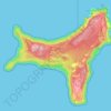
Christmas Island
Steep cliffs along much of the coast rise abruptly to a central plateau. Elevation ranges from sea level to 361 m (1,184 ft) at Murray Hill. The island is mainly tropical rainforest, 63% of which is national parkland. The narrow fringing reef surrounding the island poses a maritime hazard.
Gemiddelde hoogte: 69 m