
Topografische kaart Chelsea
Interactieve kaart
Klik op de kaart om de hoogte weer te geven.
Over deze kaart
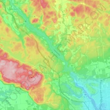
Naam: Topografische kaart Chelsea, hoogte, reliëf.
Gemiddelde hoogte: 166 m
Minimale hoogte: 42 m
Maximale hoogte: 369 m
Andere topografische kaarten
Klik op een kaart om zijn topografie, zijn hoogte en zijn reliëf te bekijken.
Saint-Louis-de-Masham
Canada > Quebec > Les Collines-de-l'Outaouais > La Pêche > Saint-Louis-de-Masham
Saint-Louis-de-Masham, La Pêche, Les Collines-de-l'Outaouais, Outaouais, Quebec, Canada
Gemiddelde hoogte: 186 m
La Pêche
Canada > Quebec > Les Collines-de-l'Outaouais > La Pêche
La Pêche, Les Collines-de-l'Outaouais, Outaouais, Quebec, Canada
Gemiddelde hoogte: 214 m