Geolokaliseren

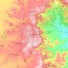
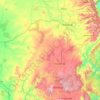
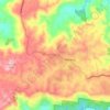
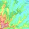
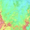
Topografische kaart Fitzroy River

Klik op de kaart om de hoogte weer te geven.

Over deze kaart

Naam: Topografische kaart Fitzroy River, hoogte, reliëf.

Locatie: Fitzroy River, Morinish, Rockhampton Regional, Queensland, Australia (-23.09170 149.98838 -23.03420 150.08614)

Gemiddelde hoogte: 61 m

Minimale hoogte: 13 m

Maximale hoogte: 283 m

Andere topografische kaarten

Klik op een kaart om zijn topografie, zijn hoogte en zijn reliëf te bekijken.
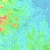
Brisbane

Australia > Queensland > Brisbane

Gemiddelde hoogte: 45 m

Toowoomba

Australia > Queensland

The city occupies the edge of the range and the low ridges behind it. Two valleys run north from the southern boundary, each arising from springs either side of Middle Ridge near Spring Street at an altitude of around 680 m. These waterways, East Creek and West Creek, flow together just north of the CBD to…

Gemiddelde hoogte: 458 m
Sunshine Coast

Australia > Queensland > Sunshine Coast Regional

The Sunshine Coast in Queensland, Australia, showcases a diverse topography that harmoniously blends coastal plains with rugged hinterlands. Along its eastern edge, the region features expansive sandy beaches and coastal dunes that transition smoothly into fertile lowlands. Inland, the terrain becomes more…

Gemiddelde hoogte: 109 m
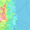
Sunshine Coast Regional

Australia > Queensland

The Sunshine Coast Regional area in Queensland, Australia, features a diverse topography that ranges from coastal plains to rugged hinterlands. Along the coastline, the terrain is predominantly flat, with average elevations around 20 meters (66 feet) above sea level. Inland, the landscape transitions to…

Gemiddelde hoogte: 56 m

Urraween

Australia > Queensland > Hervey Bay

Gemiddelde hoogte: 23 m

Townsville

Australia > Queensland

Gemiddelde hoogte: 30 m

Hervey Bay

Australia > Queensland

Gemiddelde hoogte: 6 m

Mackay

Australia > Queensland

Gemiddelde hoogte: 13 m

Noosa Heads

Australia > Queensland > Noosa Heads

Gemiddelde hoogte: 9 m

Cairns

Australia > Queensland

South of Smithfield and inland from the Northern Beaches along the edge of the Barron River flood plain are the suburbs of Caravonica, Kamerunga, Freshwater, and Stratford. This area is sometimes referred to as Freshwater Valley, though it is actually the lower part of Redlynch Valley; further up the valley…

Gemiddelde hoogte: 176 m
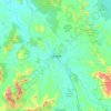
Gympie

Australia > Queensland > Gympie

Gemiddelde hoogte: 124 m

Tamborine Mountain

Australia > Queensland

Gemiddelde hoogte: 447 m

Rosevale

Australia > Queensland

Gemiddelde hoogte: 162 m

Home Hill

Australia > Queensland > Home Hill

Gemiddelde hoogte: 13 m

Bundaberg

Australia > Queensland

Gemiddelde hoogte: 18 m

Southern Downs Regional

Australia > Queensland

Gemiddelde hoogte: 594 m

Redlynch

Australia > Queensland > Cairns

Gemiddelde hoogte: 240 m

Mount Stuart

Australia > Queensland

Gemiddelde hoogte: 133 m

Ipswich

Australia > Queensland

Gemiddelde hoogte: 73 m

Kingaroy

Australia > Queensland > Kingaroy

Gemiddelde hoogte: 465 m

City of Brisbane

Australia > Queensland

Brisbane's topography is characterized by a series of hills and ranges that define its landscape. The city is situated on a low-lying floodplain, with the Brisbane River meandering through its heart, creating a winding course with many steep curves from the southwest to its mouth at Moreton Bay in the east.…

Gemiddelde hoogte: 71 m
Atherton

Australia > Queensland

Gemiddelde hoogte: 808 m

Warwick

Australia > Queensland > Warwick

Warwick has a humid subtropical climate (Köppen Cfa) with hot summers and cool to cold winters. It is slightly cooler and less humid than the proximate southeast Queensland coast due to its inland, elevation location. Frost is present in winter. The climate bears similarities with Richmond, an inland suburb…

Gemiddelde hoogte: 517 m
Bribie Island

Australia > Queensland

Gemiddelde hoogte: 44 m

Mount Gravatt East

Australia > Queensland > Logan City

Gemiddelde hoogte: 52 m

Holland Park West

Australia > Queensland

Gemiddelde hoogte: 50 m

Brisbane

Australia > Queensland

Gemiddelde hoogte: 87 m

Upper Kedron

Australia > Queensland > City of Brisbane

The proposed development responds to the site's topography by offering a range of living options, ranging from bush blocks, to lots designed for terrace-style dwellings.

Gemiddelde hoogte: 106 m

Mount Nebo

Australia > Queensland

Gemiddelde hoogte: 327 m

Russell Island

Australia > Queensland

Gemiddelde hoogte: 8 m

Yuleba

Australia > Queensland

Gemiddelde hoogte: 326 m

Gold Coast

Australia > Queensland

Gemiddelde hoogte: 42 m

D'Aguilar National Park

Australia > Queensland

Gemiddelde hoogte: 139 m

Meringandan West

Australia > Queensland

Gemiddelde hoogte: 509 m

Doonan

Australia > Queensland

Gemiddelde hoogte: 28 m

Wivenhoe Dam

Australia > Queensland

Gemiddelde hoogte: 62 m

Fraser Coast Regional

Australia > Queensland

Gemiddelde hoogte: 37 m

Albany Creek

Australia > Queensland

Gemiddelde hoogte: 37 m

Lockyer Valley Regional

Australia > Queensland

Gemiddelde hoogte: 360 m

Moffatdale

Australia > Queensland

Gemiddelde hoogte: 328 m

Bulloo Shire

Australia > Queensland

Gemiddelde hoogte: 136 m

Highfields

Australia > Queensland

Along with Meringandan, the climate is oceanic (Köppen: Cfb) due to elevation, usually located further south of Australia.

Gemiddelde hoogte: 589 m

Bellbird Park

Australia > Queensland

Gemiddelde hoogte: 50 m

Miles

Australia > Queensland

Gemiddelde hoogte: 316 m

Farleigh

Australia > Queensland

Gemiddelde hoogte: 48 m

Newport

Australia > Queensland

Gemiddelde hoogte: 3 m

Norman Creek

Australia > Queensland

Gemiddelde hoogte: 13 m

Cunnamulla

Australia > Queensland

Gemiddelde hoogte: 195 m

Cooloola

Australia > Queensland

Gemiddelde hoogte: 43 m

Gunalda

Australia > Queensland

Gemiddelde hoogte: 98 m

Rockhampton

Australia > Queensland

Gemiddelde hoogte: 48 m

Caloundra

Australia > Queensland

Caloundra, located on Queensland's Sunshine Coast, features a diverse coastal topography characterized by sandy beaches, rocky headlands, and nearby elevated terrains. The suburb of Kings Beach exemplifies this diversity, with its sandy shoreline to the south and southeast, and a rocky headland rising to about…

Gemiddelde hoogte: 5 m
Stanthorpe

Australia > Queensland > Stanthorpe

Owing to its elevation, Stanthorpe features a subtropical highland climate. At an altitude of 811 metres (2,661 ft), Stanthorpe holds the record for the lowest temperature recorded in Queensland at −10.6 °C (12.9 °F) on 23 June 1961. Sleet and light snowfalls are occasionally recorded, with the most…

Gemiddelde hoogte: 840 m
Mareeba

Australia > Queensland

Gemiddelde hoogte: 410 m

Dalby

Australia > Queensland > Dalby

Gemiddelde hoogte: 344 m

Maleny

Australia > Queensland > Maleny

Gemiddelde hoogte: 364 m

Innisfail

Australia > Queensland

Gemiddelde hoogte: 12 m

Whitsundays

Australia > Queensland

Gemiddelde hoogte: 16 m

Mount Gravatt

Australia > Queensland

Gemiddelde hoogte: 70 m

Glen Rock State Forest

Australia > Queensland

Gemiddelde hoogte: 566 m

Ipswich City

Australia > Queensland

Gemiddelde hoogte: 84 m

Burpengary

Australia > Queensland

Gemiddelde hoogte: 26 m

Bushland Beach

Australia > Queensland

Gemiddelde hoogte: 6 m

Flinders Shire

Australia > Queensland

Gemiddelde hoogte: 392 m

Palm Cove

Australia > Queensland

Gemiddelde hoogte: 46 m

Whitsundays

Australia > Queensland

Gemiddelde hoogte: 15 m

Maleny

Australia > Queensland > Maleny

Gemiddelde hoogte: 389 m

Great Keppel Island

Australia > Queensland

Gemiddelde hoogte: 12 m

Bell

Australia > Queensland > Bell

Gemiddelde hoogte: 498 m

Mount Isa

Australia > Queensland

Gemiddelde hoogte: 391 m

Esk

Australia > Queensland

Gemiddelde hoogte: 161 m

Babinda

Australia > Queensland

Gemiddelde hoogte: 89 m

Fernvale

Australia > Queensland

Gemiddelde hoogte: 64 m

Jimboomba

Australia > Queensland

Gemiddelde hoogte: 43 m

Mount Morgan

Australia > Queensland > Mount Morgan

Gemiddelde hoogte: 300 m

K'gari

Australia > Queensland

Gemiddelde hoogte: 11 m

Beaudesert

Australia > Queensland

Gemiddelde hoogte: 81 m

Murgon

Australia > Queensland > Murgon

Gemiddelde hoogte: 324 m

Pine Hill

Australia > Queensland

Gemiddelde hoogte: 100 m

River Heads

Australia > Queensland

Gemiddelde hoogte: 3 m

Byfield National Park

Australia > Queensland

Gemiddelde hoogte: 42 m

Brookstead

Australia > Queensland

Gemiddelde hoogte: 392 m

Eungella National Park

Australia > Queensland

Gemiddelde hoogte: 477 m

Purga

Australia > Queensland

Gemiddelde hoogte: 48 m

Robina

Australia > Queensland

Gemiddelde hoogte: 8 m

Ripley

Australia > Queensland

Gemiddelde hoogte: 58 m

Hamilton Island

Australia > Queensland

Gemiddelde hoogte: 21 m

Crows Nest

Australia > Queensland

Gemiddelde hoogte: 586 m

Lake Monduran

Australia > Queensland > Bundaberg Region

Gemiddelde hoogte: 97 m

Atherton Tableland

Australia > Queensland

Gemiddelde hoogte: 800 m

Kedron

Australia > Queensland

Gemiddelde hoogte: 28 m

Scenic Rim Regional

Australia > Queensland

Gemiddelde hoogte: 261 m

Goondiwindi Regional

Australia > Queensland

Gemiddelde hoogte: 315 m

Sippy Downs

Australia > Queensland

Gemiddelde hoogte: 12 m

Western Downs Regional

Australia > Queensland

Gemiddelde hoogte: 338 m

Rust jezelf uit voor je volgende avontuur:

👕Merino Wollen Shirts - Natuurlijke geurbestrijding en temperatuurregeling
⛺Kampeertenten - Lichtgewicht tenten voor trektochten in de natuur
🗺️3D Topografische Kaarten - Visuele weergave van reliëf en hoogte
🗺️Waterdichte Kaarthouders - Bescherm je papieren kaarten tegen regen
🔋Oplaadbare Batterijen - Power voor je zaklamp of GPS-toestel

Als Amazon-partner verdient deze site een commissie op in aanmerking komende aankopen, zonder extra kosten voor jou.