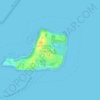
Topografische kaart Toowoomba
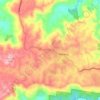
Klik op de kaart om de hoogte weer te geven.
Toowoomba
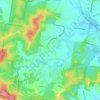
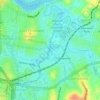
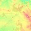
The city occupies the edge of the range and the low ridges behind it. Two valleys run north from the southern boundary, each arising from springs either side of Middle Ridge near Spring Street at an altitude of around 680 m. These waterways, East Creek and West Creek, flow together just north of the CBD to form Gowrie Creek.
Over deze kaart

Naam: Topografische kaart Toowoomba, hoogte, reliëf.
Locatie: Toowoomba, Queensland, 4350, Australia (-27.72102 151.79335 -27.40102 152.11335)
Gemiddelde hoogte: 458 m
Minimale hoogte: 126 m
Maximale hoogte: 736 m
Andere topografische kaarten
Klik op een kaart om zijn topografie, zijn hoogte en zijn reliëf te bekijken.
Sunshine Coast Regional
The Sunshine Coast Regional area in Queensland, Australia, features a diverse topography that ranges from coastal plains to rugged hinterlands. Along the coastline, the terrain is predominantly flat, with average elevations around 20 meters (66 feet) above sea level. Inland, the landscape transitions to…
Gemiddelde hoogte: 56 m




City of Brisbane
Brisbane's topography is characterized by a series of hills and ranges that define its landscape. The city is situated on a low-lying floodplain, with the Brisbane River meandering through its heart, creating a winding course with many steep curves from the southwest to its mouth at Moreton Bay in the east.…
Gemiddelde hoogte: 71 m


Upper Kedron
Australia > Queensland > City of Brisbane
The proposed development responds to the site's topography by offering a range of living options, ranging from bush blocks, to lots designed for terrace-style dwellings.
Gemiddelde hoogte: 106 m




Highfields
Along with Meringandan, the climate is oceanic (Köppen: Cfb) due to elevation, usually located further south of Australia.
Gemiddelde hoogte: 589 m





















Edmonton
The average elevation of Edmonton, Cairns is 16.8 metres (55.1 feet) above sea level.
Gemiddelde hoogte: 96 m