
Topografische kaart Bishop
Interactieve kaart
Klik op de kaart om de hoogte weer te geven.
Over deze kaart
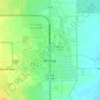
Naam: Topografische kaart Bishop, hoogte, reliëf.
Locatie: Bishop, Inyo County, California, United States (37.35367 -118.41384 37.37934 -118.38154)
Gemiddelde hoogte: 1.265 m
Minimale hoogte: 1.253 m
Maximale hoogte: 1.282 m
Bishop (formerly Bishop Creek) is a city in California, United States. It is the largest populated place and only incorporated city in Inyo County. Bishop is located near the northern end of the Owens Valley, at an elevation of 4,150 feet (1,260 m). The city was named after Bishop Creek, flowing out of the Sierra Nevada; the creek was named after Samuel Addison Bishop, a settler in the Owens Valley. Bishop is a commercial and residential center, while many vacation destinations and tourist attractions in the Sierra Nevada are located nearby.
Andere topografische kaarten
Klik op een kaart om zijn topografie, zijn hoogte en zijn reliëf te bekijken.
Mount Starr
United States > California > Inyo County
Mount Starr, Inyo County, California, United States
Gemiddelde hoogte: 3.509 m
Kearsarge Peak
United States > California > Inyo County
Kearsarge Peak, Inyo County, California, United States
Gemiddelde hoogte: 3.394 m
Badwater Basin
United States > California > Inyo County
Badwater Basin, Inyo County, California, United States
Gemiddelde hoogte: 152 m
Mount LeConte
United States > California > Inyo County
Mount LeConte, Inyo County, California, United States
Gemiddelde hoogte: 3.789 m
Kearsarge
United States > California > Inyo County
Kearsarge, Inyo County, California, United States
Gemiddelde hoogte: 1.159 m
Independence
United States > California > Inyo County
Independence, Inyo County, CAL Fire Southern Region, California, 93526, United States
Gemiddelde hoogte: 1.210 m
Death Valley Junction
United States > California > Inyo County
Death Valley Junction, Inyo County, California, United States
Gemiddelde hoogte: 627 m
Dante's View
United States > California > Inyo County
Dante's View, Inyo County, California, United States
Gemiddelde hoogte: 1.403 m
Lake Sabrina
United States > California > Inyo County
Lake Sabrina, Inyo County, California, United States
Gemiddelde hoogte: 3.033 m
Tecopa
United States > California > Inyo County > Tecopa
Tecopa, Inyo County, California, United States
Gemiddelde hoogte: 508 m
Mount Whitney
United States > California > Inyo County
Mount Whitney, Inyo County, California, United States
Gemiddelde hoogte: 3.903 m
Owens River
United States > California > Inyo County
Owens River, Inyo County, California, United States
Gemiddelde hoogte: 1.183 m
Lone Pine
United States > California > Inyo County
Lone Pine, Inyo County, CAL Fire Southern Region, California, 93545, United States
Gemiddelde hoogte: 1.298 m
Furnace Creek
United States > California > Inyo County
Furnace Creek, Inyo County, California, 92328, United States
Gemiddelde hoogte: -27 m
Crater
United States > California > Inyo County
Crater, Inyo County, California, United States
Gemiddelde hoogte: 1.657 m