

Topografische kaart Halifax
Klik op de kaart om de hoogte weer te geven.
Over deze kaart

Naam: Topografische kaart Halifax, hoogte, reliëf.
Locatie: Halifax, Halifax County, Nova Scotia, Canada (44.21437 -63.77780 45.49437 -62.49780)
Gemiddelde hoogte: 60 m
Minimale hoogte: -3 m
Maximale hoogte: 293 m
Andere topografische kaarten
Klik op een kaart om zijn topografie, zijn hoogte en zijn reliëf te bekijken.
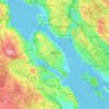
Halifax
Canada > Nova Scotia > Halifax County
The coastline is heavily indented, accounting for its length of approximately 400 km (250 mi), with the northern boundary of the municipality usually being between 50–60 km (31–37 mi) inland. The coast is mostly rock with small isolated sand beaches in sheltered bays. The largest coastal features include…
Gemiddelde hoogte: 46 m
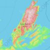
Cape Breton Island
The island is characterized by a number of elevations of ancient crystalline and metamorphic rock rising up from the south to the north, and contrasted with eroded lowlands. The bedrock of blocks that developed in different places around the globe, at different times, and then were fused together via tectonics.
Gemiddelde hoogte: 66 m


Advocate Harbour
Canada > Nova Scotia > Municipality of the County of Cumberland
Gemiddelde hoogte: 41 m






Halifax Regional Municipality
Canada > Nova Scotia > Halifax County
The coastline is heavily indented, accounting for its length of approximately 400 km (250 mi), with the northern boundary of the municipality usually being between 50–60 km (31–37 mi) inland. The coast is mostly rock with small isolated sand beaches in sheltered bays. The largest coastal features include…
Gemiddelde hoogte: 39 m


Lake Ainslie
Canada > Nova Scotia > Municipality of the County of Inverness > MacCormicks Corner
Gemiddelde hoogte: 130 m

Polletts Cove
Canada > Nova Scotia > Municipality of the County of Inverness > Meat Cove > Red River
Gemiddelde hoogte: 90 m


Sable Island
Canada > Nova Scotia > Halifax County > Sable Island
Sable Island is a narrow, crescent-shaped sandbar with a surface area estimated around 34 km2 (13 sq mi). Despite being approximately 43.15 km (26.81 mi) long, it is only 1.21 km (0.75 mi) across at its widest point. The maximum elevation is about 30 m (98 ft). The long crescent-shaped island rises gently from…
Gemiddelde hoogte: 0 m

Cape Sable Island
Canada > Nova Scotia > Shelburne County > Clark's Harbour > Newellton
Gemiddelde hoogte: 3 m


Bedford
Canada > Nova Scotia > Halifax County
The topography of the area limits the possible locations for football-and-soccer fields. However, there are fields at Basinview Drive Community School, Bedford South School, Charles P. Allen High School, Range Park, Rocky Lake Junior High, and Sunnyside Elementary (Eaglewood location).
Gemiddelde hoogte: 46 m


Bras d'Or Lake
Canada > Nova Scotia > Municipality of the County of Richmond > Red Islands
Gemiddelde hoogte: 29 m


Big Harbour Island
Canada > Nova Scotia > Municipality of the County of Inverness
Gemiddelde hoogte: 3 m


Halliburton Subdivision
Canada > Nova Scotia > Halifax County > Stillwater Lake
Gemiddelde hoogte: 96 m


Pleasant Valley
Canada > Nova Scotia > Municipality of the County of Antigonish
Gemiddelde hoogte: 167 m


