
Doe een donatie
Rust jezelf uit voor je volgende avontuur:
Als Amazon-partner verdient deze site een commissie op in aanmerking komende aankopen, zonder extra kosten voor jou.
Topografische kaart Ashton
Klik op de kaart om de hoogte weer te geven.
Doe een donatie
Rust jezelf uit voor je volgende avontuur:
Als Amazon-partner verdient deze site een commissie op in aanmerking komende aankopen, zonder extra kosten voor jou.
Ashton
Seed potatoes Ashton was first and foremost a farming community, as the soil of the area is rich and the water is plentiful. Shortly after the first settlers arrived in the 1890s, several canals were developed to divert water from streams running off the Yellowstone Plateau and Teton Range. Some farmland, mostly to the east, is high enough and close enough to the Teton Range that crops can grow without irrigation due to increased rainfall. The relatively high altitude limited crops to those requiring a short growing season such as grain and alfalfa. Seed potatoes were not tried as a crop until 1920 but as it turns out, the area is perfect for seed potatoes. The short growing season keeps the potatoes desirably small, and the long, cold winters create the ideal conditions for seed. The longtime enemy to potato farming is potato blight, a form of mold that reproduces from spores in the soil and sickens the potato plant. Ashton's winters clean the soil of these mold spores with a long, deep and killing freeze. Potato blight never spreads because the soil is clean and free of spores each spring. After realizing this, farmers organized, hired inspectors, and began selling certified seed potatoes giving buyers comfort that Ashton seed was free of molds and disease. This enabled them to demand a premium price for these potatoes grown in the clean soils around Ashton and the area quickly became the largest seed potato producing area in the world as it is still known today.
Doe een donatie
Rust jezelf uit voor je volgende avontuur:
Als Amazon-partner verdient deze site een commissie op in aanmerking komende aankopen, zonder extra kosten voor jou.
Over deze kaart
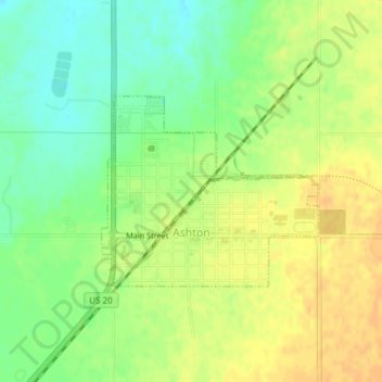
Naam: Topografische kaart Ashton, hoogte, reliëf.
Locatie: Ashton, Fremont County, Idaho, United States (44.06777 -111.45714 44.08123 -111.43578)
Gemiddelde hoogte: 1.601 m
Minimale hoogte: 1.585 m
Maximale hoogte: 1.614 m
Doe een donatie
Rust jezelf uit voor je volgende avontuur:
Als Amazon-partner verdient deze site een commissie op in aanmerking komende aankopen, zonder extra kosten voor jou.
Andere topografische kaarten
Klik op een kaart om zijn topografie, zijn hoogte en zijn reliëf te bekijken.