
Topografische kaart The Municipal District of Nenagh
Interactieve kaart
Klik op de kaart om de hoogte weer te geven.
Over deze kaart
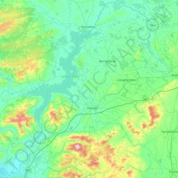
Naam: Topografische kaart The Municipal District of Nenagh, hoogte, reliëf.
Gemiddelde hoogte: 116 m
Minimale hoogte: 0 m
Maximale hoogte: 688 m
Andere topografische kaarten
Klik op een kaart om zijn topografie, zijn hoogte en zijn reliëf te bekijken.
Derrycastle
Derrycastle, The Municipal District of Nenagh, County Tipperary, Munster, Irland
Gemiddelde hoogte: 152 m
Borrisoleigh
Irland > County Tipperary > Borrisoleigh
Borrisoleigh, The Municipal District of Thurles, County Tipperary, Munster, Irland
Gemiddelde hoogte: 128 m