

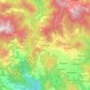
Topografische kaart Nainital
Klik op de kaart om de hoogte weer te geven.
Nainital
Nainital is located in the Kumaon foothills of the outer Himalayas at a distance of 276 km (171 mi) from the state capital Dehradun and 314 km (195 mi) from New Delhi, the capital of India. Situated at an altitude of 1,938 metres (6,358 ft) above sea level, the town is set in a valley containing an eye-shaped lake, approximately two miles in circumference, and surrounded by mountains, of which the highest are Naina Peak (2,615 m (8,579 ft)) on the north, Deopatha (2,438 m (7,999 ft)) on the west, and Ayarpatha (2,278 m (7,474 ft)) on the south. From the tops of the higher peaks, "magnificent views can be obtained of the vast plain to the south, or of the mass of tangled ridges lying north, bound by the great snowy range which forms the central axis of the Himalayas." The hill station attracts tourists round the year.
Over deze kaart
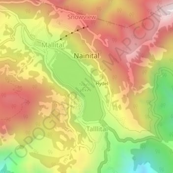
Naam: Topografische kaart Nainital, hoogte, reliëf.
Locatie: Nainital, Uttarakhand, 263003, India (29.37263 79.43883 29.39879 79.46999)
Gemiddelde hoogte: 2.059 m
Minimale hoogte: 1.562 m
Maximale hoogte: 2.449 m
Andere topografische kaarten
Klik op een kaart om zijn topografie, zijn hoogte en zijn reliëf te bekijken.


Bhowali
India > Uttarakhand > Nainital
Bhowali (Kumaoni: Bhoāli)[bʱəʋaːli] is a town and municipal board in Nainital District in the state of Uttarakhand, India. It is situated at a distance of 11 km (6.8 mi) from the city of Nainital, the district headquarters; at an average elevation of 1,654 m (5,427 ft) from sea level. It is the seat of…
Gemiddelde hoogte: 1.672 m


