

Topografische kaart Salem
Klik op de kaart om de hoogte weer te geven.
Salem
Salem is located at 11°40′N 78°08′E / 11.67°N 78.14°E / 11.67; 78.14, at an average elevation of 278 m (912 ft). The city is surrounded by hills: Nagaramalai on the north, Jarugumalai on the south, Kanjamalai on the west, Godumalai on the east and the Shevaroy Hills on the northeast. Kariyaperumal Hill is in southwestern Salem. The Thirumanimutharu River flows through the city, dividing it in two. The fort area is the oldest part of Salem.
Over deze kaart
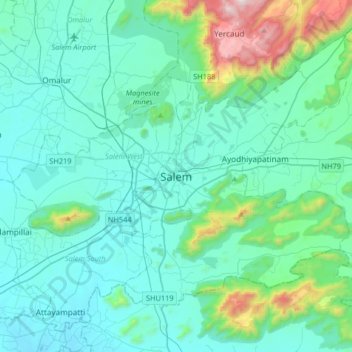
Naam: Topografische kaart Salem, hoogte, reliëf.
Locatie: Salem, Salem District, Tamil Nadu, 636001, India (11.49520 77.99818 11.81520 78.31818)
Gemiddelde hoogte: 418 m
Minimale hoogte: 216 m
Maximale hoogte: 1.622 m
Andere topografische kaarten
Klik op een kaart om zijn topografie, zijn hoogte en zijn reliëf te bekijken.
Chennai
Chennai is located on the southeastern coast of India in the northeastern part of Tamil Nadu on a flat coastal plain known as the Eastern Coastal Plains with an average elevation of 6.7 m (22 ft) and highest point at 60 m (200 ft). Chennai's soil is mostly clay, shale and sandstone. Clay underlies most of the…
Gemiddelde hoogte: 8 m
Chennai
Chennai is located on the southeastern coast of India in the northeastern part of Tamil Nadu on a flat coastal plain known as the Eastern Coastal Plains with an average elevation of 6.7 m (22 ft) and highest point at 60 m (200 ft). Chennai's soil is mostly clay, shale and sandstone. Clay underlies most of the…
Gemiddelde hoogte: 8 m
Chennai
Chennai district covers an area of 426 km2 located on the Eastern Coastal Plains of India. It is situated on the northeastern corner of Tamil Nadu along the Coramandel coast, a region bounded by the Bay of Bengal and is surrounded inland by the districts of Tiruvallur, Kanchipuram and Chengalpattu. It lies…
Gemiddelde hoogte: 12 m

Coimbatore
Apart from the species common to the plains, wild elephants, wild boars leopards, tigers, bison, species of deer, Nilgiri tahr, sloth bear and black-headed oriole can be found. The Anamalai Wildlife Sanctuary 88 km (55 mi) in the Western Ghats at an altitude of 1,400 meters covers an area of 958 km2. More than…
Gemiddelde hoogte: 551 m
Madurai
India > Tamil Nadu > Madurai
Madurai is located at 9°56′N 78°07′E / 9.93°N 78.12°E / 9.93; 78.12. It has an average elevation of 101 metres. The city of Madurai lies on the flat and fertile plain of the river Vaigai, which runs in the northwest-southeast direction through the city, dividing it into two almost equal…
Gemiddelde hoogte: 138 m
Tirunelveli
India > Tamil Nadu > Palayamkottai
Tirunelveli is located at 8°43′41.82″N 77°41′43.94″E / 8.7282833°N 77.6955389°E / 8.7282833; 77.6955389, and its average elevation is 47 metres (154 ft). It is located at the southernmost tip of the Deccan plateau. The Tamirabarani River divides the city into the Tirunelveli quarter and…
Gemiddelde hoogte: 34 m
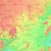

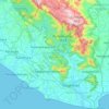
Kanniyakumari
Kanyakumari district has a varied topography with sea on three sides and the mountains of the Western Ghats bordering the northern side. Except for a small stretch of land to the west of Kanyakumari town, almost the entire district is sandwiched between the Western Ghats and the Arabian Sea - the only district…
Gemiddelde hoogte: 226 m
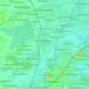


Karur
With headquarters at Karur, it is the centrally located district of Tamil Nadu. It is bounded by Namakkal district in the north, Dindigul district in the south, Tiruchirapalli district on the east and Erode & Tiruppur districts on the west. Karur is located at 10°57'° N 78°4'° E has an average elevation of…
Gemiddelde hoogte: 166 m


Nilgiris
The district has an area of 2,552.50 km2. The district is basically hilly, lying at an elevation of 1,000 to 2,600 metres above MSL, and divided between the Nilgiri plateau and the lower, smaller Wayanad plateau. The district lies at the juncture of the Western Ghats and the Eastern Ghats. Its latitudinal and…
Gemiddelde hoogte: 975 m
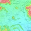




Erode
Western Ghats runs through the district and it is straddled by Eastern Ghats which is separated by Moyar River. The region comprises the high altitude regions of the north sloping gently towards a long undulating plain in the south. Bhavani River cuts the district roughly in the middle, flowing from west to…
Gemiddelde hoogte: 512 m





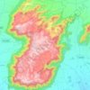


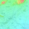


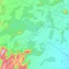

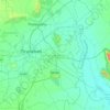






Kanchipuram
The Palar river is the most important river running through the district. Through most of the year it remains dry, attributed to the construction of dams across the river in Andhra Pradesh. There are only a few hills of considerable elevation in the district. The southern part of Maduranthakam taluk contains…
Gemiddelde hoogte: 38 m

Salem
Salem is located at 11°40′N 78°08′E / 11.67°N 78.14°E / 11.67; 78.14, at an average elevation of 278 m (912 ft.). The city is surrounded by hills: Nagaramalai on the north, Jarugumalai on the south, Kanjamalai on the west, Godumalai on the east and the Shevaroy Hills on the northeast.…
Gemiddelde hoogte: 400 m






Namakkal
Besides the above two zones, Kolli Hills (a part of the Eastern Ghats mountain range) and a few isolated hills and ridges are scattered over Namakkal, Rasipuram, and Tiruchengode and along with the valleys and rolling hills, make up the characteristic topography of the district.
Gemiddelde hoogte: 261 m

Tirunelveli
Located between 1,000 metres (3,300 ft) and 1,500 metres (4,900 ft) of elevation, the Manjolai area is set deep within the Western Ghats within the Kalakad Mundanthurai Tiger Reserve in the Tirunelveli District. Located on top of the Manimuthar Dam and the Manimuthar Water Falls, the Manjolai area comprises…
Gemiddelde hoogte: 196 m


