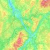
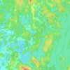
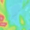
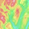
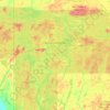
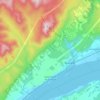
Topografische kaart Lac-Simon
Klik op de kaart om de hoogte weer te geven.
Over deze kaart

Naam: Topografische kaart Lac-Simon, hoogte, reliëf.
Locatie: Lac-Simon, Abitibi-Témiscamingue, Quebec, Canada (48.03840 -77.37414 48.07840 -77.33414)
Gemiddelde hoogte: 321 m
Minimale hoogte: 310 m
Maximale hoogte: 363 m
Andere topografische kaarten
Klik op een kaart om zijn topografie, zijn hoogte en zijn reliëf te bekijken.
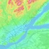
Quebec
Canada > Quebec > Urban agglomeration of Québec
Quebec City was built on the north bank of the Saint Lawrence River, where it narrows and meets the mouth of the Saint-Charles River. Old Quebec is located on top and at the foot of Cap-Diamant, which is on the eastern edge of a plateau called the promontory of Quebec (Quebec hill). Because of this topographic…
Gemiddelde hoogte: 117 m
Pierrefonds-Roxboro
Canada > Quebec > Urban agglomeration of Montreal > Montreal
Gemiddelde hoogte: 30 m
Lanaudière
The region of Lanaudière is part of central Quebec and is located between the Saint Lawrence River and the Laurentian Mountains, between Mauricie and the Laurentides. Lanaudière attracts a good deal of interest from vacationers due to its unique character founded largely on the harmony between its culture…
Gemiddelde hoogte: 332 m
Forêt Montmorency
Canada > Quebec > La Côte-de-Beaupré > Lac-Jacques-Cartier
Located in the Laurentian Mountains, the Montmorency forest is drained by the Montmorency River and by one of its tributaries, the Black river. There are four lakes: Lac Piché, Bédard, Laflamme and Joncas. The altitude varies between 600 and 1,000 meters (3,300 ft) with an average of 750 meters. The…
Gemiddelde hoogte: 794 m


Gatineau
Gatineau is located in southwestern Quebec, on the northern bank of the Gatineau River. It is situated at an elevation of around 50 m (164.042 ft) The Gatineau Hills are the foothills of the Laurentian Mountains and located in the region. It is also the location of the second largest urban park in the world.…
Gemiddelde hoogte: 127 m
Quebec
Canada > Quebec > Urban agglomeration of Québec
Quebec City was built on the north bank of the Saint Lawrence River, where it narrows and meets the mouth of the Saint-Charles River. Old Quebec is located on top and at the foot of Cap-Diamant, which is on the eastern edge of a plateau called the promontory of Quebec (Quebec hill). Because of this topographic…
Gemiddelde hoogte: 117 m











Île de la Grande Entrée
Canada > Quebec > Urban agglomeration of Les Îles-de-la-Madeleine > Les Îles-de-la-Madeleine > Grande-Entrée
Gemiddelde hoogte: 2 m


Mont-Tremblant
Canada > Quebec > Les Laurentides
The city is dominated by Mont Tremblant with an altitude of 968m which is one of the highest peaks in southern Quebec.
Gemiddelde hoogte: 358 m