Geolokaliseren

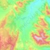
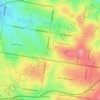
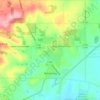
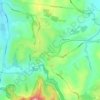
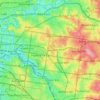
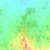
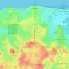
Topografische kaart Stanhope

Klik op de kaart om de hoogte weer te geven.

Over deze kaart

Naam: Topografische kaart Stanhope, hoogte, reliëf.

Locatie: Stanhope, Shire of Campaspe, Victoria, Australia (-36.46496 144.96324 -36.42496 145.00324)

Gemiddelde hoogte: 108 m

Minimale hoogte: 104 m

Maximale hoogte: 111 m

Andere topografische kaarten

Klik op een kaart om zijn topografie, zijn hoogte en zijn reliëf te bekijken.
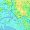
City of Melbourne

Australia > Victoria

Melbourne's topography is characterized by a diverse landscape that transitions from flat coastal plains to rolling hills and mountainous regions. The city is situated at the northern end of Port Phillip Bay, where the terrain is predominantly flat, facilitating urban development. As one moves eastward, the…

Gemiddelde hoogte: 18 m
Melbourne

Australia > Victoria

Melbourne is also prone to isolated convective showers forming when a cold pool crosses the state, especially if there is considerable daytime heating. These showers are often heavy and can include hail, squalls, and significant drops in temperature, but they often pass through very quickly with a rapid…

Gemiddelde hoogte: 185 m

Melbourne

Australia > Victoria

Melbourne is also prone to isolated convective showers forming when a cold pool crosses the state, especially if there is considerable daytime heating. These showers are often heavy and can include hail, squalls, and significant drops in temperature, but they often pass through very quickly with a rapid…

Gemiddelde hoogte: 185 m
Kilmore

Australia > Victoria

Gemiddelde hoogte: 349 m

Kyneton

Australia > Victoria

Gemiddelde hoogte: 504 m

Foster

Australia > Victoria

Gemiddelde hoogte: 81 m

Shire of South Gippsland

Australia > Victoria

Gemiddelde hoogte: 81 m

Shire of Macedon Ranges

Australia > Victoria

Gemiddelde hoogte: 464 m

Wilsons Promontory

Australia > Victoria

Gemiddelde hoogte: 38 m

Kew

Australia > Victoria > Melbourne

Gemiddelde hoogte: 38 m

Grampians National Park

Australia > Victoria

Mount William is known within the gliding community for the "Grampians Wave", a weather phenomenon that sometimes enables glider pilots to reach extreme altitudes of the order of 28,000 ft (8,500 m). This predominantly occurs during the months of May, June, September and October when strong westerly winds flow…

Gemiddelde hoogte: 262 m

Swan Hill

Australia > Victoria

Gemiddelde hoogte: 72 m

Hillside

Australia > Victoria > Melbourne

Gemiddelde hoogte: 134 m

Montrose

Australia > Victoria > Melbourne

Montrose varies in altitude from about 91 m to 324 m above sea level. Montrose covers an area of 11 square kilometres (2,700 acres).

Gemiddelde hoogte: 235 m

Viewbank

Australia > Victoria > Melbourne

Gemiddelde hoogte: 42 m

Bright

Australia > Victoria

Gemiddelde hoogte: 550 m

Apollo Bay

Australia > Victoria

Gemiddelde hoogte: 136 m

Port Phillip

Australia > Victoria

Port Phillip's mostly flat topography and moderate waves make perfect conditions for recreational swimming, kitesurfing, windsurfing, sailing, boating, snorkeling, scuba diving, stand up paddle boarding (SUP) and other sports.

Gemiddelde hoogte: 18 m

Shire of Mansfield

Australia > Victoria

Gemiddelde hoogte: 748 m

Yackandandah

Australia > Victoria

Gemiddelde hoogte: 469 m

Stawell

Australia > Victoria

Gemiddelde hoogte: 227 m

Creswick

Australia > Victoria

Gemiddelde hoogte: 469 m

Kilsyth

Australia > Victoria

Gemiddelde hoogte: 151 m

Hernes Oak

Australia > Victoria

Gemiddelde hoogte: 128 m

Sorrento

Australia > Victoria

Gemiddelde hoogte: 9 m

Ocean Grove

Australia > Victoria

Gemiddelde hoogte: 23 m

Trawool

Australia > Victoria

Gemiddelde hoogte: 344 m

Baranduda

Australia > Victoria

Gemiddelde hoogte: 235 m

Korumburra South

Australia > Victoria

Gemiddelde hoogte: 118 m

Skye

Australia > Victoria

Gemiddelde hoogte: 35 m

Wodonga

Australia > Victoria

Gemiddelde hoogte: 191 m

Howqua Hills

Australia > Victoria

Gemiddelde hoogte: 676 m

Wollert

Australia > Victoria

Gemiddelde hoogte: 191 m

Mount Martha

Australia > Victoria

Gemiddelde hoogte: 40 m

Warburton

Australia > Victoria

Gemiddelde hoogte: 525 m

Mount Eliza

Australia > Victoria > Melbourne

Gemiddelde hoogte: 60 m

Mirboo North

Australia > Victoria

Gemiddelde hoogte: 216 m

Gippsland

Australia > Victoria

Gemiddelde hoogte: 273 m

Woodlands Historic Park

Australia > Victoria > Melbourne

Gemiddelde hoogte: 139 m

Rosebud

Australia > Victoria > Melbourne

Gemiddelde hoogte: 44 m

Glenaladale

Australia > Victoria

Gemiddelde hoogte: 132 m

Albert Park

Australia > Victoria

Heritage Victoria notes that Albert Park's St Vincent Gardens "is historically important as the premier 'square' development in Victoria based on similar models in London. It is significant as the largest development of its type in Victoria and for its unusual development as gardens rather than the more usual…

Gemiddelde hoogte: 6 m
Mansfield

Australia > Victoria

Gemiddelde hoogte: 401 m

Campbells Creek

Australia > Victoria

Gemiddelde hoogte: 319 m

Everton

Australia > Victoria

Gemiddelde hoogte: 229 m

Porepunkah

Australia > Victoria

Gemiddelde hoogte: 473 m

Hume

Australia > Victoria

Gemiddelde hoogte: 359 m

Murchison North

Australia > Victoria

Gemiddelde hoogte: 121 m

Yarraville

Australia > Victoria

Gemiddelde hoogte: 17 m

Maribyrnong

Australia > Victoria > Melbourne

Gemiddelde hoogte: 23 m

Balwyn

Australia > Victoria

Gemiddelde hoogte: 77 m

North Melbourne

Australia > Victoria

Gemiddelde hoogte: 24 m

Lorne

Australia > Victoria

Gemiddelde hoogte: 161 m

Castlemaine

Australia > Victoria

The Castlemaine goldfields' legendary prosperity raised expectations of Castlemaine becoming Victoria's second city. That is reflected in imposing buildings erected in the town's first few years. Though the rich alluvial diggings were largely exhausted within 15–20 years causing the town's population to…

Gemiddelde hoogte: 319 m
Mount Buller

Australia > Victoria

Due to its far south-western location in the alpine region, Mount Buller is more susceptible to cold airmasses which allow it to record some of the lowest maximum temperatures and daytime readings in the country, despite being considerably lower in elevation than other mountain sites to the north-east. On 5…

Gemiddelde hoogte: 824 m
Grampians

Australia > Victoria

Gemiddelde hoogte: 151 m

Oakleigh

Australia > Victoria

Gemiddelde hoogte: 66 m

Mornington District

Australia > Victoria > Melbourne

Gemiddelde hoogte: 50 m

Halls Gap

Australia > Victoria

Gemiddelde hoogte: 406 m

Emerald

Australia > Victoria > Melbourne

Gemiddelde hoogte: 225 m

Omeo

Australia > Victoria

There are bus routes from Bright and Bairnsdale. The Bairnsdale bus runs weekdays, once both directions, and the Bright bus (Alps Link) timetable is less frequent in Summer and runs additional services during the ski season. Alps Link is the highest altitude public bus in Australia. The town sits at the…

Gemiddelde hoogte: 861 m

Caulfield District

Australia > Victoria

Gemiddelde hoogte: 35 m

Balnarring

Australia > Victoria

Gemiddelde hoogte: 59 m

Beaconsfield Upper

Australia > Victoria

Gemiddelde hoogte: 153 m

Mount Evelyn

Australia > Victoria

Gemiddelde hoogte: 189 m

Lake Boga

Australia > Victoria

Gemiddelde hoogte: 72 m

Great Otway National Park

Australia > Victoria

Gemiddelde hoogte: 91 m

Fawcett

Australia > Victoria

Gemiddelde hoogte: 391 m

Axedale

Australia > Victoria

Gemiddelde hoogte: 186 m

Lake Eildon

Australia > Victoria > Mansfield

Gemiddelde hoogte: 376 m

Ballarat East

Australia > Victoria

Gemiddelde hoogte: 477 m

City of Boroondara

Australia > Victoria

Gemiddelde hoogte: 53 m

Shepparton

Australia > Victoria

Gemiddelde hoogte: 114 m

Port Fairy

Australia > Victoria

Gemiddelde hoogte: 22 m

Noradjuha

Australia > Victoria

Gemiddelde hoogte: 150 m

Eppalock

Australia > Victoria

Gemiddelde hoogte: 214 m

Fitzroy Gardens

Australia > Victoria > Melbourne

Gemiddelde hoogte: 27 m

City of Greater Bendigo

Australia > Victoria

Gemiddelde hoogte: 200 m

Lake Victoria

Australia > Victoria

Gemiddelde hoogte: 5 m

City of Greater Shepparton

Australia > Victoria

Gemiddelde hoogte: 128 m

Warrenheip

Australia > Victoria

Gemiddelde hoogte: 531 m

Mitta Mitta

Australia > Victoria

Gemiddelde hoogte: 739 m

Poowong East

Australia > Victoria

Gemiddelde hoogte: 195 m

Wesburn

Australia > Victoria > Melbourne

Gemiddelde hoogte: 362 m

Cowes

Australia > Victoria

Gemiddelde hoogte: 27 m

Mount Camel

Australia > Victoria

Gemiddelde hoogte: 223 m

Taggerty

Australia > Victoria

Gemiddelde hoogte: 404 m

Selwyn

Australia > Victoria

Gemiddelde hoogte: 1.094 m

French Island

Australia > Victoria

Gemiddelde hoogte: 12 m

Flinders

Australia > Victoria

Gemiddelde hoogte: 53 m

Wye River

Australia > Victoria

Gemiddelde hoogte: 325 m

Wandella

Australia > Victoria

Gemiddelde hoogte: 81 m

Longford

Australia > Victoria

Gemiddelde hoogte: 45 m

Wallington

Australia > Victoria

Gemiddelde hoogte: 33 m

Suggan Buggan

Australia > Victoria

Gemiddelde hoogte: 708 m

Nalinga

Australia > Victoria

Gemiddelde hoogte: 146 m

Maryvale

Australia > Victoria

Gemiddelde hoogte: 70 m

Timbarra

Australia > Victoria

Gemiddelde hoogte: 376 m

Rust jezelf uit voor je volgende avontuur:

📱Outdoor Smartphonehouders - Bescherm je smartphone tijdens hikes
🔌Reisadapters - Voor de grensstreken en internationale trips
🔭Telescopen - Bestudeer de sterrenhemel vanaf een donkere plek
🔋Oplaadbare Batterijen - Power voor je zaklamp of GPS-toestel
🥪Broodtrommels & Lunchboxen - Houd je maaltijden vers tijdens je topografische verkenning

Als Amazon-partner verdient deze site een commissie op in aanmerking komende aankopen, zonder extra kosten voor jou.