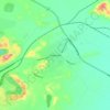
Topografische kaart Lake Brockman
Klik op de kaart om de hoogte weer te geven.
Over deze kaart

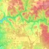
Naam: Topografische kaart Lake Brockman, hoogte, reliëf.
Gemiddelde hoogte: 244 m
Minimale hoogte: 152 m
Maximale hoogte: 297 m
Andere topografische kaarten
Klik op een kaart om zijn topografie, zijn hoogte en zijn reliëf te bekijken.
Perth
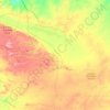
Perth, the capital of Western Australia, is situated on the Swan Coastal Plain, a flat expanse of sandy soil nestled between the Indian Ocean to the west and the Darling Scarp to the east. The Darling Scarp, also known as the Darling Range, is a low escarpment that extends north–south, marking a distinct…
Gemiddelde hoogte: 26 m






Ellenbrook
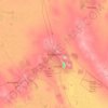
The suburb sits in the south-east corner of the Gnangara Mound, close to the Darling Scarp. Topographically, the majority of Ellenbrook's area sits between 40-50 metres above sea level on the mound, with parts of Coolamon and Malvern Springs situated on hills that reach peaks of 65 metres. The northern village…
Gemiddelde hoogte: 49 m















Nullarbor Plain
Australia > Western Australia > Forrest
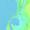
One theory is that the whole area was uplifted by crustal movements in the Miocene, and since then, erosion by wind and rain has reduced its thickness. The plain has most likely never had any major defining topographic features, resulting in the extremely flat terrain across the plain today.
Gemiddelde hoogte: 131 m




Bluff Knoll
Due to its elevation, Bluff Knoll and the surrounding peaks of the Stirling Ranges are some of only a few places to experience regular snowfalls in Western Australia. When snow is forecast by the Bureau of Meteorology it attracts hikers from all over the southwest region to experience it.
Gemiddelde hoogte: 663 m