
Topografische kaart Agutaya
Interactieve kaart
Klik op de kaart om de hoogte weer te geven.
Over deze kaart
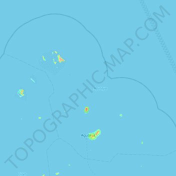
Naam: Topografische kaart Agutaya, hoogte, reliëf.
Locatie: Agutaya, Palawan, Mimaropa, 5320, Philippines (11.05096 120.62093 11.60087 121.28635)
Gemiddelde hoogte: 0 m
Minimale hoogte: 0 m
Maximale hoogte: 255 m
Andere topografische kaarten
Klik op een kaart om zijn topografie, zijn hoogte en zijn reliëf te bekijken.
Puerto Princesa
Philippines > Palawan > Puerto Princesa
Puerto Princesa, Palawan, Mimaropa, 5300, Philippines
Gemiddelde hoogte: 92 m
Pass Island
Philippines > Palawan > Busuanga
Pass Island, Busuanga, Palawan, Mimaropa, 5317, Philippines
Gemiddelde hoogte: 20 m
Cataban
Philippines > Palawan > Cataban
Cataban, Palawan, Mimaropa, Philippines
Gemiddelde hoogte: 79 m
Busuanga Island
Busuanga Island, Coron, Palawan, Mimaropa, 5316, Philippines
Gemiddelde hoogte: 33 m
Taraw Peak
Taraw Peak, Palawan, Mimaropa, 5313, Philippines
Gemiddelde hoogte: 57 m