
Topografische kaart Boroka Lookout
Interactieve kaart
Klik op de kaart om de hoogte weer te geven.
Over deze kaart
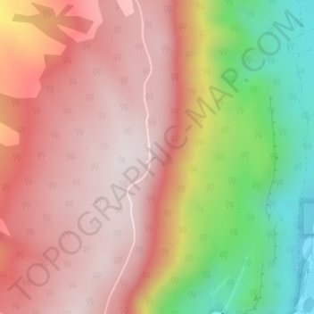
Naam: Topografische kaart Boroka Lookout, hoogte, reliëf.
Gemiddelde hoogte: 614 m
Minimale hoogte: 220 m
Maximale hoogte: 860 m
Andere topografische kaarten
Klik op een kaart om zijn topografie, zijn hoogte en zijn reliëf te bekijken.
Boulder Rock
Australia > Victoria > Halls Gap
Boulder Rock, Halls Gap, Shire of Northern Grampians, Victoria, 3381, Australia
Gemiddelde hoogte: 304 m
Brambuk - The National Park and Cultural Centre Park
Australia > Victoria > Halls Gap
Brambuk - The National Park and Cultural Centre Park, Halls Gap, Shire of Northern Grampians, Victoria, 3381, Australia
Gemiddelde hoogte: 372 m