
Topografische kaart Gillan
Klik op de kaart om de hoogte weer te geven.
Over deze kaart
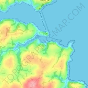
Naam: Topografische kaart Gillan, hoogte, reliëf.
Gemiddelde hoogte: 29 m
Minimale hoogte: 0 m
Maximale hoogte: 112 m
Andere topografische kaarten
Klik op een kaart om zijn topografie, zijn hoogte en zijn reliëf te bekijken.
St. Columb Major
United Kingdom > England > Cornwall
St Columb occupies a plateau at about 300 feet (91 m) elevation. The north part of the town (known as 'Bridge') descends into the Vale of Lanherne, having a minimum elevation of approximately 165 feet (50 m). It was originally a linear settlement built on the main road running north-east to south-west, but…
Gemiddelde hoogte: 110 m