
Topografische kaart Slaithwaite
Klik op de kaart om de hoogte weer te geven.
Slaithwaite
In the 1848 edition of 'A Topographical Dictionary of England', Samuel Lewis (the editor) wrote:- "the lands are in meadow and pasture, with a small portion of arable; the scenery is bold and romantic. In the quarries of the district are found vegetable fossils, especially firs and other mountain trees. The village is beautifully seated in the valley of the river Colne; the inhabitants are chiefly employed in the woollen manufacture, in the spinning of cotton and silk, and in silk-weaving"
Over deze kaart
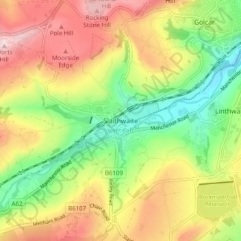
Naam: Topografische kaart Slaithwaite, hoogte, reliëf.
Gemiddelde hoogte: 241 m
Minimale hoogte: 107 m
Maximale hoogte: 391 m
Andere topografische kaarten
Klik op een kaart om zijn topografie, zijn hoogte en zijn reliëf te bekijken.