

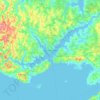
Topografische kaart Queens County
Klik op de kaart om de hoogte weer te geven.
Over deze kaart

Naam: Topografische kaart Queens County, hoogte, reliëf.
Locatie: Queens County, Prince Edward Island, Canada (45.94383 -63.62339 46.56645 -62.66644)
Gemiddelde hoogte: 18 m
Minimale hoogte: -3 m
Maximale hoogte: 141 m
Andere topografische kaarten
Klik op een kaart om zijn topografie, zijn hoogte en zijn reliëf te bekijken.




Prince Edward Island National Park
Canada > Prince Edward Island > Kings County > Greenwich
Gemiddelde hoogte: 2 m


French Village
Canada > Prince Edward Island > Queens County > Savage Harbour, Queen's County
Gemiddelde hoogte: 12 m


Rural Municipality of Eastern Kings
Canada > Prince Edward Island > Rural Municipality of Eastern Kings
Gemiddelde hoogte: 9 m
