

Topografische kaart Dundee
Klik op de kaart om de hoogte weer te geven.
Over deze kaart

Naam: Topografische kaart Dundee, hoogte, reliëf.
Locatie: Dundee, Kings County, Prince Edward Island, Canada (46.39251 -62.77789 46.41251 -62.75789)
Gemiddelde hoogte: 24 m
Minimale hoogte: 0 m
Maximale hoogte: 50 m
Andere topografische kaarten
Klik op een kaart om zijn topografie, zijn hoogte en zijn reliëf te bekijken.


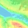

Rural Municipality of Murray River
Canada > Prince Edward Island > Kings County
Gemiddelde hoogte: 20 m


Prince Edward Island National Park
Canada > Prince Edward Island > Kings County > Greenwich
Gemiddelde hoogte: 2 m




Rural Municipality of Murray River
Canada > Prince Edward Island > Kings County
Gemiddelde hoogte: 20 m