Geolokaliseren

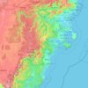
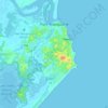
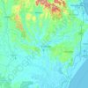
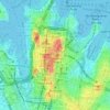
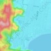
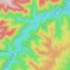
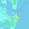
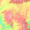
Topografische kaart Newcastle

Klik op de kaart om de hoogte weer te geven.

Over deze kaart

Naam: Topografische kaart Newcastle, hoogte, reliëf.

Locatie: Newcastle, Newcastle-Maitland, City of Newcastle, New South Wales, 2300, Australia (-33.08729 151.62125 -32.76729 151.94125)

Gemiddelde hoogte: 9 m

Minimale hoogte: -4 m

Maximale hoogte: 204 m

Andere topografische kaarten

Klik op een kaart om zijn topografie, zijn hoogte en zijn reliëf te bekijken.
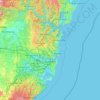
Sydney

Australia > New South Wales

Sydney's topography is characterized by a diverse landscape that seamlessly blends coastal features with inland plateaus. The city is divided into two primary regions: the relatively flat Cumberland Plain to the south and west of Sydney Harbour, and the elevated Hornsby Plateau to the north. The Cumberland…

Gemiddelde hoogte: 51 m

Lismore

Australia > New South Wales

Gemiddelde hoogte: 23 m

Newcastle

Australia > New South Wales > Newcastle

Gemiddelde hoogte: 5 m

Orange

Australia > New South Wales

Orange is a city in the Central Tablelands region of New South Wales, Australia. It is 254 km (158 mi) west of the state capital, Sydney [206 km (128 mi) on a great circle], at an altitude of 862 metres (2,828 ft). Orange had an estimated urban population of 40,493 as of June 2018 making the city a significant…

Gemiddelde hoogte: 852 m

Delegate

Australia > New South Wales

Gemiddelde hoogte: 841 m

Marrickville

Australia > New South Wales > Sydney

Gemiddelde hoogte: 17 m

Port Macquarie

Australia > New South Wales

Gemiddelde hoogte: 5 m

Randwick

Australia > New South Wales > Sydney

Gemiddelde hoogte: 44 m

Glen Innes

Australia > New South Wales

Gemiddelde hoogte: 1.083 m

Bundeena

Australia > New South Wales

Gemiddelde hoogte: 20 m

Carrington

Australia > New South Wales > Newcastle

Gemiddelde hoogte: 3 m

Cooma

Australia > New South Wales

Gemiddelde hoogte: 869 m

Woombah

Australia > New South Wales

Gemiddelde hoogte: 14 m

Moruya

Australia > New South Wales

Gemiddelde hoogte: 37 m

Parramatta

Australia > New South Wales

Gemiddelde hoogte: 22 m

Barrington Tops

Australia > New South Wales

Gemiddelde hoogte: 1.107 m

Georges River

Australia > New South Wales

Gemiddelde hoogte: 120 m

Penrith

Australia > New South Wales > Sydney > Penrith

Penrith is a city in New South Wales, Australia, located in Greater Western Sydney, 55 kilometres (31 mi) west of the Sydney central business district on the banks of the Nepean River, on the outskirts of the Cumberland Plain. Its elevation is 32 metres (105 ft).

Gemiddelde hoogte: 34 m

Yass

Australia > New South Wales

Yass is located 280 km south-west of Sydney, on the Hume Highway. The Yass River, which is a tributary of the Murrumbidgee River, flows through the town. Yass is 59 km from Canberra; lying at an elevation of 505 m AMSL.

Gemiddelde hoogte: 533 m
Engadine

Australia > New South Wales > Sydney

Gemiddelde hoogte: 121 m

Wauchope

Australia > New South Wales

Gemiddelde hoogte: 32 m

Rosehill

Australia > New South Wales > Sydney

Gemiddelde hoogte: 9 m

Northern Beaches

Australia > New South Wales > Sydney

Gemiddelde hoogte: 67 m

Griffith

Australia > New South Wales

Gemiddelde hoogte: 131 m

Calderwood

Australia > New South Wales

Gemiddelde hoogte: 100 m

Bowral

Australia > New South Wales

Gemiddelde hoogte: 690 m

Moree

Australia > New South Wales

Gemiddelde hoogte: 216 m

Illawarra

Australia > New South Wales

Gemiddelde hoogte: 234 m

Talbingo

Australia > New South Wales

Gemiddelde hoogte: 740 m

Woodenbong

Australia > New South Wales

Gemiddelde hoogte: 474 m

Luddenham

Australia > New South Wales

Gemiddelde hoogte: 72 m

Knockrow

Australia > New South Wales

Gemiddelde hoogte: 54 m

Windradyne

Australia > New South Wales

Gemiddelde hoogte: 702 m

Moruya Heads

Australia > New South Wales

Gemiddelde hoogte: 9 m

Bondi State Forest

Australia > New South Wales

Gemiddelde hoogte: 711 m

Goulburn

Australia > New South Wales

Owing to its elevation, Goulburn has an oceanic climate (Cfb) with warm summers and cool winters; with a high diurnal range. Its climate is variable much of the year, though generally dry with maximum temperatures ranging from 11.8 °C (53.2 °F) in July to 28.3 °C (82.9 °F) in January. Rainfall is…

Gemiddelde hoogte: 666 m
Byron Bay

Australia > New South Wales

Byron Bay, located in northeastern New South Wales, Australia, is characterized by diverse topography shaped by its geological history. The town is part of the erosion caldera of the ancient Tweed Volcano, which erupted approximately 23 million years ago, resulting in the rich volcanic soils that define the…

Gemiddelde hoogte: 7 m
Islington

Australia > New South Wales > Newcastle

Gemiddelde hoogte: 6 m

Baulkham Hills

Australia > New South Wales > Sydney

Gemiddelde hoogte: 93 m

Chatswood

Australia > New South Wales

Gemiddelde hoogte: 81 m

Haberfield

Australia > New South Wales > Sydney

Gemiddelde hoogte: 18 m

Gordon

Australia > New South Wales > Sydney

Gemiddelde hoogte: 101 m

Wollongbar

Australia > New South Wales

Gemiddelde hoogte: 134 m

Sydney

Australia > New South Wales > Sydney

Gemiddelde hoogte: 23 m

Raymond Terrace

Australia > New South Wales

Gemiddelde hoogte: 9 m

Castle Hill

Australia > New South Wales

Gemiddelde hoogte: 123 m

Bondi Beach

Australia > New South Wales > Sydney

Gemiddelde hoogte: 31 m

Gillieston Heights

Australia > New South Wales

Gemiddelde hoogte: 12 m

Gulgong

Australia > New South Wales

Gemiddelde hoogte: 454 m

Coorabell

Australia > New South Wales

Gemiddelde hoogte: 70 m

Diehard

Australia > New South Wales

Gemiddelde hoogte: 816 m

Mandurama

Australia > New South Wales

Gemiddelde hoogte: 742 m

Kanwal

Australia > New South Wales

Gemiddelde hoogte: 23 m

Wakeley

Australia > New South Wales > Sydney

Gemiddelde hoogte: 31 m

Hampton

Australia > New South Wales

Gemiddelde hoogte: 959 m

Shoalhaven Heads

Australia > New South Wales

Gemiddelde hoogte: 5 m

Wingham

Australia > New South Wales

Gemiddelde hoogte: 47 m

San Remo

Australia > New South Wales

Gemiddelde hoogte: 16 m

Northmead

Australia > New South Wales

Gemiddelde hoogte: 52 m

Rutherford

Australia > New South Wales

Gemiddelde hoogte: 23 m

Mittagong

Australia > New South Wales

Gemiddelde hoogte: 672 m

Little Hartley

Australia > New South Wales

Gemiddelde hoogte: 790 m

Leura

Australia > New South Wales

Leura's elevation of 985 metres (3,232 ft) AHD  leads to occasional snowfall in winter and a climate that reflects all four seasons distinctly.

Gemiddelde hoogte: 880 m
Avoca Beach

Australia > New South Wales

Gemiddelde hoogte: 23 m

Umina Beach

Australia > New South Wales

Gemiddelde hoogte: 38 m

King Creek

Australia > New South Wales > Wauchope > King Creek

Gemiddelde hoogte: 6 m

Goonellabah

Australia > New South Wales

Gemiddelde hoogte: 86 m

Bangalow

Australia > New South Wales

Gemiddelde hoogte: 83 m

Lake Cathie

Australia > New South Wales

Gemiddelde hoogte: 6 m

North Sydney

Australia > New South Wales > Sydney

Gemiddelde hoogte: 50 m

Bywong

Australia > New South Wales

Gemiddelde hoogte: 734 m

Tantangara Reservoir

Australia > New South Wales

Gemiddelde hoogte: 1.276 m

Stanwell Tops

Australia > New South Wales

Gemiddelde hoogte: 187 m

Shoal Bay

Australia > New South Wales

Gemiddelde hoogte: 16 m

Glen Davis

Australia > New South Wales

Gemiddelde hoogte: 619 m

Kowmung River

Australia > New South Wales

Gemiddelde hoogte: 379 m

Dubbo

Australia > New South Wales

Gemiddelde hoogte: 318 m

Malua Bay

Australia > New South Wales

Gemiddelde hoogte: 22 m

Dunedoo

Australia > New South Wales

Gemiddelde hoogte: 467 m

Belmont

Australia > New South Wales

Gemiddelde hoogte: 14 m

Yamba

Australia > New South Wales

Gemiddelde hoogte: 2 m

East Lismore

Australia > New South Wales

Gemiddelde hoogte: 41 m

Charlotte Pass

Australia > New South Wales

Gemiddelde hoogte: 1.854 m

Tenterfield

Australia > New South Wales

Gemiddelde hoogte: 891 m

Rust jezelf uit voor je volgende avontuur:

🧥Outdoor Winterjassen - Isolatie voor koude wandeltochten
🗺️Fysieke Kaarten België - De perfecte aanvulling op digitale topografie
🦯Nordic Walking Stokken - Specifieke stokken voor sportief wandelen
🛶Dry Bags - Bescherm je elektronica tegen water
🏔️Altimeters - Meet nauwkeurig hoogteverschillen tijdens wandelingen

Als Amazon-partner verdient deze site een commissie op in aanmerking komende aankopen, zonder extra kosten voor jou.