
Topografische kaart Satyamangalam
Klik op de kaart om de hoogte weer te geven.
Satyamangalam
Sathyamangalam is situated on the southern side of the Western Ghats, which extend towards the east from the Nilgiri mountains. The general topography is not flat and covered by sloping lands. Bhavani river flows at the center of the town from west to east. Agricultural wet lands are predominant on both sides of the river and dry lands are predominant on the northern side of the town. The soil mainly consists of black loam, red loam and red sand.
Over deze kaart
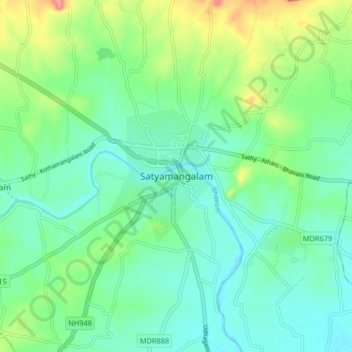
Naam: Topografische kaart Satyamangalam, hoogte, reliëf.
Gemiddelde hoogte: 248 m
Minimale hoogte: 224 m
Maximale hoogte: 310 m
Andere topografische kaarten
Klik op een kaart om zijn topografie, zijn hoogte en zijn reliëf te bekijken.