
Topografische kaart Poprad
Interactieve kaart
Klik op de kaart om de hoogte weer te geven.
Poprad
International Poprad–Tatry Airport from 1938, is an airport with the highest elevations in Central Europe. It also offers scheduled flights to London.
Over deze kaart
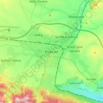
Naam: Topografische kaart Poprad, hoogte, reliëf.
Gemiddelde hoogte: 699 m
Minimale hoogte: 584 m
Maximale hoogte: 932 m