Topografische kaart tsunt War
Interactieve kaart
Klik op de kaart om de hoogte weer te geven.
Over deze kaart
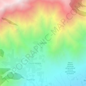
Naam: Topografische kaart tsunt War, hoogte, reliëf.
Gemiddelde hoogte: 2.374 m
Minimale hoogte: 1.640 m
Maximale hoogte: 3.558 m

Klik op de kaart om de hoogte weer te geven.
Naam: Topografische kaart tsunt War, hoogte, reliëf.
Gemiddelde hoogte: 2.374 m
Minimale hoogte: 1.640 m
Maximale hoogte: 3.558 m