
Topografische kaart Saqqez
Interactieve kaart
Klik op de kaart om de hoogte weer te geven.
Saqqez
At an altitude of 1,476 metres (4,842 feet), Saqqez has a Mediterranean continental climate (Köppen climate classification Dsa) with hot, very dry summers and cold, snowy winters. Summers feature large diurnal temperature variation due to decreased air density at high altitude and low humidity. In 1969 Saqqez recorded a temperature of −36 °C (−33 °F), the lowest ever recorded by an Iranian weather station until Kheirabad Zanjan recorded −36.4 °C (−33.5 °F) on January 29, 1997. Saqqez again reached −36 °C during the February 3–9 1972 Iran blizzard.
Over deze kaart
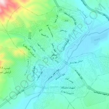
Naam: Topografische kaart Saqqez, hoogte, reliëf.
Gemiddelde hoogte: 1.527 m
Minimale hoogte: 1.448 m
Maximale hoogte: 1.893 m
Andere topografische kaarten
Klik op een kaart om zijn topografie, zijn hoogte en zijn reliëf te bekijken.