
Topografische kaart Klausenpass
Interactieve kaart
Klik op de kaart om de hoogte weer te geven.
Klausenpass
Klausen Pass (German: Klausenpass; elevation: 1,948 metres or 6,391 feet) is a high mountain pass in the Swiss Alps connecting Altdorf in the canton of Uri with Linthal in the canton of Glarus. Somewhat unusually, the boundary between the two cantons does not lie at the summit of the pass, but some 8 kilometres (5.0 mi) down the slope towards Linthal, with the summit being in Uri.
Over deze kaart
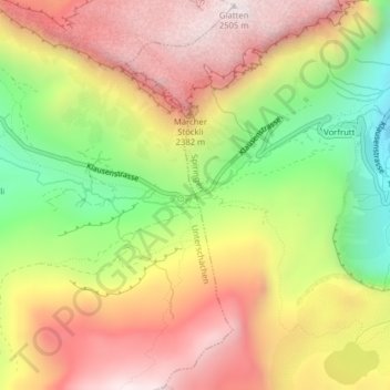
Naam: Topografische kaart Klausenpass, hoogte, reliëf.
Locatie: Klausenpass, Unterschächen, Uri, 6465, Switzerland (46.86814 8.85539 46.86824 8.85549)
Gemiddelde hoogte: 2.103 m
Minimale hoogte: 1.631 m
Maximale hoogte: 2.509 m