
Bedankt voor het steunen van deze site ❤️
Doe een donatie
Doe een donatie
Rust jezelf uit voor je volgende avontuur:
Als Amazon-partner verdient deze site een commissie op in aanmerking komende aankopen, zonder extra kosten voor jou.
Topografische kaart Lonesand
Klik op de kaart om de hoogte weer te geven.
Bedankt voor het steunen van deze site ❤️
Doe een donatie
Doe een donatie
Rust jezelf uit voor je volgende avontuur:
Als Amazon-partner verdient deze site een commissie op in aanmerking komende aankopen, zonder extra kosten voor jou.
Over deze kaart
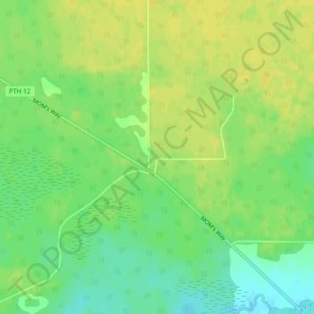
Naam: Topografische kaart Lonesand, hoogte, reliëf.
Locatie: Lonesand, Rural Municipality of Stuartburn, Manitoba, Canada (49.21273 -96.31538 49.23273 -96.29538)
Gemiddelde hoogte: 328 m
Minimale hoogte: 316 m
Maximale hoogte: 336 m
Bedankt voor het steunen van deze site ❤️
Doe een donatie
Doe een donatie
Rust jezelf uit voor je volgende avontuur:
Als Amazon-partner verdient deze site een commissie op in aanmerking komende aankopen, zonder extra kosten voor jou.