
Topografische kaart Sullurpeta
Interactieve kaart
Klik op de kaart om de hoogte weer te geven.
Sullurpeta
Sullurupeta is located about 77 km east of Tirupati, 90 km south of Nellore and about 83 km north of Chennai, Tamilnadu. It is 16 km west of the world-famous ISRO island Sriharikota, where the Indian rockets are launched. The Pulicat lake separates Sullurpeta and Sriharikota. It has an average elevation of 11 meters (36 feet).
Over deze kaart
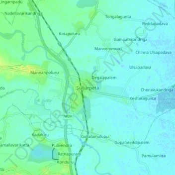
Naam: Topografische kaart Sullurpeta, hoogte, reliëf.
Locatie: Sullurpeta, Tirupati District, Andhra Pradesh, 524121, India (13.66129 79.98070 13.74129 80.06070)
Gemiddelde hoogte: 4 m
Minimale hoogte: -2 m
Maximale hoogte: 15 m