Geolokaliseren

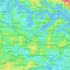
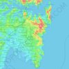
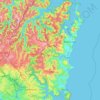
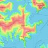
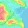
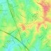
Topografische kaart Rocky Point Island

Klik op de kaart om de hoogte weer te geven.

Over deze kaart

Naam: Topografische kaart Rocky Point Island, hoogte, reliëf.

Locatie: Rocky Point Island, Sydney, New South Wales, 2088, Australia (-34.14330 150.93233 -33.50330 151.57233)

Gemiddelde hoogte: 39 m

Minimale hoogte: -3 m

Maximale hoogte: 271 m

Andere topografische kaarten

Klik op een kaart om zijn topografie, zijn hoogte en zijn reliëf te bekijken.
Penrith

Australia > New South Wales > Sydney > Penrith

Penrith is a city in New South Wales, Australia, located in Greater Western Sydney, 55 kilometres (31 mi) west of the Sydney central business district on the banks of the Nepean River, on the outskirts of the Cumberland Plain. Its elevation is 32 metres (105 ft).

Gemiddelde hoogte: 34 m
Kenthurst

Australia > New South Wales > Sydney

Gemiddelde hoogte: 100 m

Inner West

Australia > New South Wales > Sydney

Gemiddelde hoogte: 19 m

Annandale

Australia > New South Wales > Sydney

Gemiddelde hoogte: 24 m

Fairlight

Australia > New South Wales > Sydney

Gemiddelde hoogte: 23 m

Sydney

Australia > New South Wales > Sydney

Gemiddelde hoogte: 23 m

Hornsby

Australia > New South Wales > Sydney

Gemiddelde hoogte: 160 m

Milperra

Australia > New South Wales > Sydney

Gemiddelde hoogte: 8 m

Eastern Suburbs

Australia > New South Wales > Sydney

Gemiddelde hoogte: 12 m

Enmore

Australia > New South Wales > Sydney

Gemiddelde hoogte: 23 m

Darling Point

Australia > New South Wales > Sydney

Gemiddelde hoogte: 23 m

Camden Council

Australia > New South Wales > Sydney

Gemiddelde hoogte: 90 m

Padstow Heights

Australia > New South Wales > Sydney

Gemiddelde hoogte: 26 m

Inner West

Australia > New South Wales > Sydney

Gemiddelde hoogte: 19 m

Sutherland Shire

Australia > New South Wales > Sydney

Gemiddelde hoogte: 79 m

Hunters Hill

Australia > New South Wales > Sydney

Gemiddelde hoogte: 24 m

Cremorne Point

Australia > New South Wales > Sydney

Gemiddelde hoogte: 29 m

Inner West Council

Australia > New South Wales > Sydney

Gemiddelde hoogte: 19 m

Wolli Creek

Australia > New South Wales > Sydney

Gemiddelde hoogte: 27 m

Botany Bay

Australia > New South Wales > Sydney

Gemiddelde hoogte: 8 m

Blacktown

Australia > New South Wales > Sydney

Gemiddelde hoogte: 57 m

Northern Beaches

Australia > New South Wales > Sydney

Gemiddelde hoogte: 67 m

Lower North Shore

Australia > New South Wales > Sydney

Gemiddelde hoogte: 45 m

Edensor Park

Australia > New South Wales > Sydney

Gemiddelde hoogte: 57 m

Darlinghurst

Australia > New South Wales > Sydney

Gemiddelde hoogte: 38 m

Leichhardt

Australia > New South Wales > Sydney

Gemiddelde hoogte: 22 m

Berowra

Australia > New South Wales > Sydney

Berowra is located 44 kilometres north of the Sydney CBD and lies at an altitude of 215 metres. Surrounded by bushland, it borders the national parks of both the Berowra Valley and Ku-ring-gai Chase.

Gemiddelde hoogte: 144 m

Glenfield

Australia > New South Wales > Sydney

Gemiddelde hoogte: 29 m

Earlwood

Australia > New South Wales > Sydney

Gemiddelde hoogte: 23 m

Engadine

Australia > New South Wales > Sydney

Gemiddelde hoogte: 121 m

North Sydney

Australia > New South Wales > Sydney

Gemiddelde hoogte: 50 m

Marrickville

Australia > New South Wales > Sydney

Gemiddelde hoogte: 17 m

Kingswood

Australia > New South Wales > Sydney > Penrith

Gemiddelde hoogte: 53 m

Box Hill

Australia > New South Wales > Sydney

Gemiddelde hoogte: 45 m

Artarmon

Australia > New South Wales > Sydney

Gemiddelde hoogte: 81 m

Cheltenham

Australia > New South Wales > Sydney

Gemiddelde hoogte: 105 m

Camellia

Australia > New South Wales > Sydney

Gemiddelde hoogte: 11 m

Scheyville

Australia > New South Wales > Sydney

Gemiddelde hoogte: 38 m

Ingleside

Australia > New South Wales > Sydney

Gemiddelde hoogte: 89 m

Gadigal Green

Australia > New South Wales > Sydney

Gemiddelde hoogte: 26 m

Mosman

Australia > New South Wales > Sydney

Gemiddelde hoogte: 29 m

Schofields

Australia > New South Wales > Sydney

Gemiddelde hoogte: 32 m

Bankstown

Australia > New South Wales > Sydney

Gemiddelde hoogte: 34 m

Freshwater

Australia > New South Wales > Sydney

Gemiddelde hoogte: 14 m

Bondi Beach

Australia > New South Wales > Sydney

Gemiddelde hoogte: 31 m

Clovelly

Australia > New South Wales > Sydney

Gemiddelde hoogte: 32 m

Jim Walsh Park

Australia > New South Wales > Sydney

Gemiddelde hoogte: 80 m

Waverton

Australia > New South Wales > Sydney

Gemiddelde hoogte: 33 m

Holroyd

Australia > New South Wales > Sydney

Gemiddelde hoogte: 24 m

Killarney Heights

Australia > New South Wales > Sydney

Gemiddelde hoogte: 72 m

Gregory Hills

Australia > New South Wales > Sydney

Gregory Hills is a suburb of Sydney in the state of New South Wales, Australia in Camden Council. The suburb was assigned on 1 August 2008. The suburb was named from the topography of the local area and from the original St Gregory's Chapel on the Marist Brothers land.

Gemiddelde hoogte: 109 m
Oran Park

Australia > New South Wales > Sydney

Gemiddelde hoogte: 93 m

Baulkham Hills

Australia > New South Wales > Sydney

Gemiddelde hoogte: 93 m

Randwick

Australia > New South Wales > Sydney

Gemiddelde hoogte: 44 m

Mount Kuring-Gai

Australia > New South Wales > Sydney

Mount Kuring-gai is located approximately 7 km north of Hornsby. Its neighbouring suburbs are Berowra to the north, and Mount Colah to the south. Surrounded by bushland, it is bordered by Ku-ring-gai Chase National Park on the eastern side and by Berowra Valley Regional Park on the western side. There are…

Gemiddelde hoogte: 133 m
St Ives

Australia > New South Wales > Sydney

Gemiddelde hoogte: 125 m

Mount Druitt

Australia > New South Wales > Sydney

Gemiddelde hoogte: 52 m

Turramurra

Australia > New South Wales > Sydney

Gemiddelde hoogte: 143 m

Haberfield

Australia > New South Wales > Sydney

Gemiddelde hoogte: 18 m

Barangaroo

Australia > New South Wales > Sydney

Gemiddelde hoogte: 15 m

Dee Why

Australia > New South Wales > Sydney

Gemiddelde hoogte: 31 m

Rose Bay

Australia > New South Wales > Sydney

Gemiddelde hoogte: 31 m

Epping

Australia > New South Wales > Sydney

Gemiddelde hoogte: 96 m

Allambie Heights

Australia > New South Wales > Sydney

Gemiddelde hoogte: 77 m

Wentworth Falls

Australia > New South Wales > Sydney

Wentworth Falls (postcode: 2782) is a town in the Blue Mountains region of New South Wales, situated approximately 100 kilometres (62 mi) west of the Sydney central business district, and about 8 kilometres (5.0 mi) east of Katoomba, Australia on the Great Western Highway, with a Wentworth Falls railway…

Gemiddelde hoogte: 708 m

Canterbury-Bankstown Council

Australia > New South Wales > Sydney

Within the same year 16 US fighter planes that were based at Bankstown airport flew over Canterbury racecourse at low altitude during a race meet. This was to let the Australian public, especially those of the district to know that they, their allies were there for their protection. Regardless of these events,…

Gemiddelde hoogte: 26 m

Warragamba Dam

Australia > New South Wales > Sydney

Gemiddelde hoogte: 156 m

Hills District

Australia > New South Wales > Sydney

Gemiddelde hoogte: 91 m

St Helens Park

Australia > New South Wales > Sydney

Gemiddelde hoogte: 138 m

Strawberry Hills

Australia > New South Wales > Sydney

Gemiddelde hoogte: 32 m

East Gordon Park

Australia > New South Wales > Sydney

Gemiddelde hoogte: 107 m

Yeramba Lagoon

Australia > New South Wales > Sydney

Gemiddelde hoogte: 27 m

Cockatoo Island

Australia > New South Wales > Sydney

Gemiddelde hoogte: 11 m

St Johns Park

Australia > New South Wales > Sydney

Gemiddelde hoogte: 36 m

North Ryde Common

Australia > New South Wales > Sydney

Gemiddelde hoogte: 58 m

Point Piper

Australia > New South Wales > Sydney

Gemiddelde hoogte: 13 m

Woronora

Australia > New South Wales > Sydney

Woronora Plateau, is a geographical region adjacent to the Sydney Plain. Slightly higher in altitude, it is capped with Hawkesbury Sandstone. The Woronora River flows through the deeply dissected plateau to the Georges River from near the sources of the Port Hacking, within the Sutherland Shire.

Gemiddelde hoogte: 65 m
Carramar

Australia > New South Wales > Sydney

Gemiddelde hoogte: 14 m

Sylvania

Australia > New South Wales > Sydney

Gemiddelde hoogte: 19 m

Scotland Island

Australia > New South Wales > Sydney

Gemiddelde hoogte: 17 m

Woodford

Australia > New South Wales > Sydney

Woodford is a village in the Blue Mountains in New South Wales, Australia, about 90 kilometres west of Sydney. Its elevation is 609 metres (1,998 ft) above sea level. It is situated on the Great Western Highway and has a railway station (opened in 1868 as Buss's Platform) on the Main Western railway line…

Gemiddelde hoogte: 544 m
Hurstville

Australia > New South Wales > Sydney

Gemiddelde hoogte: 50 m

Rockdale

Australia > New South Wales > Sydney

Gemiddelde hoogte: 20 m

Wicks Park

Australia > New South Wales > Sydney

Gemiddelde hoogte: 17 m

Bella Vista

Australia > New South Wales > Sydney

Gemiddelde hoogte: 79 m

Berkshire Park

Australia > New South Wales > Sydney

Gemiddelde hoogte: 27 m

St Leonards

Australia > New South Wales > Sydney

Gemiddelde hoogte: 69 m

Meadowbank Park

Australia > New South Wales > Sydney

Gemiddelde hoogte: 14 m

Denistone West

Australia > New South Wales > Sydney

Gemiddelde hoogte: 55 m

Rust jezelf uit voor je volgende avontuur:

🧼Biologische Zeep - Was jezelf of je spullen milieuvriendelijk
📦Outdoor Opbergzakken - Organiseer je uitrusting efficiënt
👣Stappentellers - Meet je dagelijkse activiteit eenvoudig
📡Satelliet Communicators - Blijf bereikbaar in afgelegen gebieden
👖Regenbroeken - Volledige bescherming tegen de natte elementen

Als Amazon-partner verdient deze site een commissie op in aanmerking komende aankopen, zonder extra kosten voor jou.