
Topografische kaart Verhniy Ufaley
Interactieve kaart
Klik op de kaart om de hoogte weer te geven.
Verhniy Ufaley
Lake Itkul, located at the altitude of 720 meters (2,360 ft) above sea level, is one of the notable natural wonders in Verkhny Ufaley. It is fed by springs, creeks, and small rivers, so its waters renew within a year and are fresh and clean. The lake is clear but has a brownish reflection. The lake and its vicinity have become a popular destination for Verkhny Ufaley's residents and visitors alike.
Over deze kaart
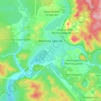
Naam: Topografische kaart Verhniy Ufaley, hoogte, reliëf.
Gemiddelde hoogte: 404 m
Minimale hoogte: 347 m
Maximale hoogte: 540 m