
Topografische kaart Bickerton Hill
Interactieve kaart
Klik op de kaart om de hoogte weer te geven.
Bickerton Hill
Bickerton Hill refers to two low red sandstone hills that form the southern end of the Mid Cheshire Ridge in Cheshire, north-west England. The high point, Raw Head, lies on the northerly hill and has an elevation of 227 metres. Parts of the southerly hill are also known as Larkton Hill.
Over deze kaart
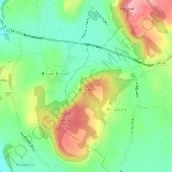
Naam: Topografische kaart Bickerton Hill, hoogte, reliëf.
Gemiddelde hoogte: 134 m
Minimale hoogte: 77 m
Maximale hoogte: 221 m