
Topografische kaart Madison
Interactieve kaart
Klik op de kaart om de hoogte weer te geven.
Over deze kaart
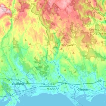
Naam: Topografische kaart Madison, hoogte, reliëf.
Gemiddelde hoogte: 69 m
Minimale hoogte: -2 m
Maximale hoogte: 219 m
Andere topografische kaarten
Klik op een kaart om zijn topografie, zijn hoogte en zijn reliëf te bekijken.
Lake Whitney
United States > Connecticut > South Central COG > Hamden
Lake Whitney, Hamden, South Central COG, Connecticut, United States
Gemiddelde hoogte: 25 m
Branford Hills
United States > Connecticut > South Central COG > Branford
Branford Hills, Branford, South Central COG, Connecticut, 06405, United States
Gemiddelde hoogte: 12 m
North Guilford
United States > Connecticut > South Central COG > Guilford
North Guilford, Guilford, South Central COG, Connecticut, United States
Gemiddelde hoogte: 79 m
Whitney Peak
United States > Connecticut > South Central COG > Hamden
Whitney Peak, Hamden, South Central COG, Connecticut, 06517, United States
Gemiddelde hoogte: 19 m