
Topografische kaart Kennesaw
Interactieve kaart
Klik op de kaart om de hoogte weer te geven.
Over deze kaart
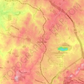
Naam: Topografische kaart Kennesaw, hoogte, reliëf.
Locatie: Kennesaw, Cobb County, Georgia, 30144, United States (33.98343 -84.65549 34.06343 -84.57549)
Gemiddelde hoogte: 318 m
Minimale hoogte: 167 m
Maximale hoogte: 393 m
Kennesaw is located in northwestern Cobb County, bordered by the city of Acworth to the northwest. Kennesaw Mountain is located southeast of the city limits in the battlefield park. Its summit is the highest point in the Atlanta metro area, at an elevation of 1,808 feet (551 m) above sea level. The city was renamed for the mountain.