Geolokaliseren

Topografische kaart Finch

Interactieve kaart

Klik op de kaart om de hoogte weer te geven.

Over deze kaart

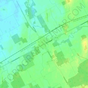
Naam: Topografische kaart Finch, hoogte, reliëf.

Locatie: Finch, North Stormont, Stormont, Dundas and Glengarry Counties, Eastern Ontario, Ontario, K0C 1K0, Canada (45.12322 -75.10493 45.16322 -75.06493)

Gemiddelde hoogte: 83 m

Minimale hoogte: 73 m

Maximale hoogte: 97 m

Andere topografische kaarten

Klik op een kaart om zijn topografie, zijn hoogte en zijn reliëf te bekijken.

Moose Creek

Canada > Ontario > Stormont, Dundas and Glengarry Counties > North Stormont

Moose Creek, North Stormont, Stormont, Dundas and Glengarry Counties, Eastern Ontario, Ontario, K0C 1W0, Canada

Gemiddelde hoogte: 87 m

Finch

Canada > Ontario > Stormont, Dundas and Glengarry Counties > North Stormont

Finch, North Stormont, Stormont, Dundas and Glengarry Counties, Eastern Ontario, Ontario, Canada

Gemiddelde hoogte: 80 m

Monkland

Canada > Ontario > Stormont, Dundas and Glengarry Counties > North Stormont

Monkland, North Stormont, Stormont, Dundas and Glengarry Counties, Eastern Ontario, Ontario, K0C 1V0, Canada

Gemiddelde hoogte: 102 m