

Topografische kaart Kalai
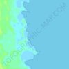
Klik op de kaart om de hoogte weer te geven.
Over deze kaart

Naam: Topografische kaart Kalai, hoogte, reliëf.
Locatie: Kalai, Kivalliq Region, Nunavut, Canada (66.02247 -84.79562 66.03404 -84.76654)
Gemiddelde hoogte: 1 m
Minimale hoogte: 0 m
Maximale hoogte: 33 m
Andere topografische kaarten
Klik op een kaart om zijn topografie, zijn hoogte en zijn reliëf te bekijken.
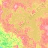




Yathkyed Lake
Canada > Nunavut > Kivalliq Region
It is part of the Hearne Domain, Western Churchill province of the Churchill craton, which is the northwest section of the Canadian Shield. According to the Atlas of Canada the geographical centre of the country lies just south of the lake at 62°24′N 096°28′W / 62.400°N 96.467°W / 62.400;…
Gemiddelde hoogte: 142 m
