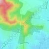
Topografische kaart Splitters Creek
Klik op de kaart om de hoogte weer te geven.
Splitters Creek
The Splitters Creek valley is classed as a very high fire risk by the NSW Rural Fire Service (one of two in NSW) due to the topography and the access with only 1 road in and out.
Over deze kaart

Naam: Topografische kaart Splitters Creek, hoogte, reliëf.
Gemiddelde hoogte: 214 m
Minimale hoogte: 141 m
Maximale hoogte: 479 m
Andere topografische kaarten
Klik op een kaart om zijn topografie, zijn hoogte en zijn reliëf te bekijken.