
Topografische kaart Jiroft
Interactieve kaart
Klik op de kaart om de hoogte weer te geven.
Jiroft
Jiroft is located in a vast plain, Halil River, on the southern outskirts of the Jebal Barez mountain chain, surrounded by two rivers. The mean elevation of the city is about 650 metres (2,130 ft) above sea level. The weather of the city is sweltering in summer – it is one of the hottest places in Iran – but temperatures are moderate in winter.
Over deze kaart
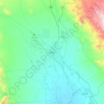
Naam: Topografische kaart Jiroft, hoogte, reliëf.
Gemiddelde hoogte: 896 m
Minimale hoogte: 583 m
Maximale hoogte: 2.392 m