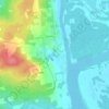
Topografische kaart Sunbury County
Klik op de kaart om de hoogte weer te geven.
Over deze kaart

Naam: Topografische kaart Sunbury County, hoogte, reliëf.
Locatie: Sunbury County, New Brunswick, Canada (45.49939 -66.93631 46.39645 -65.85141)
Gemiddelde hoogte: 104 m
Minimale hoogte: -4 m
Maximale hoogte: 388 m
Andere topografische kaarten
Klik op een kaart om zijn topografie, zijn hoogte en zijn reliëf te bekijken.

Thighmaster Boulder
Canada > New Brunswick > City of Fredericton > Fredericton
Gemiddelde hoogte: 90 m







Havelock
Canada > New Brunswick > Butternut Valley Rural Community > Havelock Parish
Gemiddelde hoogte: 93 m

Saint-Isidore
Canada > New Brunswick > Municipality of Hautes-Terres > Saint-Isidore Parish
Gemiddelde hoogte: 58 m

Saint John River
Canada > New Brunswick > Haut-Madawaska > Saint-Francois Parish > Saint-François-de-Madawaska
The eastern Algonquin languages had different dialects associated with each of the major river systems of New England and the Maritimes; and there was often a linguistic bifurcation between residents of the upper river and those living along the coast and tidal estuary. The Passamaquoddy hunted sea mammals…
Gemiddelde hoogte: 179 m


Little Branch
Canada > New Brunswick > Greater Miramichi Rural District > Glenelg Parish
Gemiddelde hoogte: 10 m

Edmundston
Canada > New Brunswick > Edmundston
Edmundston has a downhill skiing facility in the city at Mont Farlagne. This facility has 3 lifts, a t-bar, a double chair, and a quad chair. It has 14 trails and an elevation of 690 feet. Snowmaking is available. Five trails are lit for night skiing.
Gemiddelde hoogte: 256 m














Mount Carleton
Canada > New Brunswick > Greater Miramichi Rural District > Northesk Parish
Gemiddelde hoogte: 657 m




Keswick Ridge
Canada > New Brunswick > Central York Rural Community > Bright Parish
Gemiddelde hoogte: 43 m

Memramcook Lake
Canada > New Brunswick > Westmorland County > Dorchester Parish
Gemiddelde hoogte: 19 m
Saint John
Canada > New Brunswick > Saint John
The topography surrounding Saint John is hilly; a result of the influence of two coastal mountain ranges which run along the Bay of Fundy – the St. Croix Highlands and the Caledonia Highlands. The soil throughout the region is extremely rocky with frequent granite outcrops. The coastal plain hosts numerous…
Gemiddelde hoogte: 44 m