Topografische kaart Marienberg
Klik op de kaart om de hoogte weer te geven.
Marienberg
The town is situated on a plateau north of the Ore Mountains ridge, at an elevation between 460 and 891 metres above sea level. It is approximately 31 kilometres south of Chemnitz, to which it is connected via the Flöha Valley Railway.
Over deze kaart
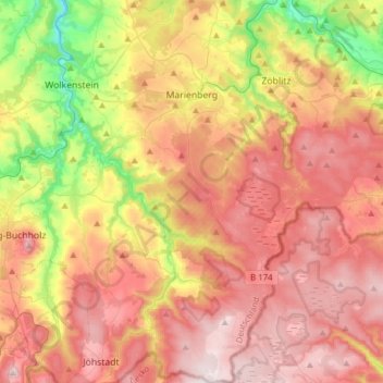
Naam: Topografische kaart Marienberg, hoogte, reliëf.
Locatie: Marienberg, Erzgebirgskreis, Saxony, 09496, Germany (50.50289 13.11699 50.69897 13.32772)
Gemiddelde hoogte: 657 m
Minimale hoogte: 356 m
Maximale hoogte: 901 m
Andere topografische kaarten
Klik op een kaart om zijn topografie, zijn hoogte en zijn reliëf te bekijken.

Markersbach
Germany > Saxony > Erzgebirgskreis
In 1889, Markersbach was connected to the railway line from Schwarzenberg to Annaberg, which was closed to passenger transport on 27 September 1997. The station lay in Mittweida’s municipal area and the platform signs read Mittweida-Markersbach. To overcome the great elevation differential, the railway's…
Gemiddelde hoogte: 600 m