Topografische kaart Bhuj
Klik op de kaart om de hoogte weer te geven.
Bhuj
Bhuj has an average elevation of 110 metres (360 feet). On the eastern side of the city is a hill known as Bhujia Hill, on which there is a Bhujia Fort, that separates Bhuj city and Madhapar town ( considered one of the richest villages in Asia ). It has two lakes namely Hamirsar and Deshadsar (દેેેશળસર).
Over deze kaart
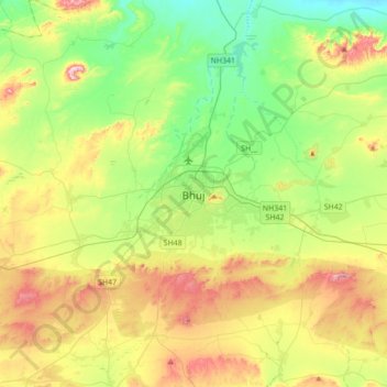
Naam: Topografische kaart Bhuj, hoogte, reliëf.
Locatie: Bhuj, Bhuj Taluka, Kachchh, Gujarat, 370001, India (23.08724 69.50834 23.40724 69.82834)
Gemiddelde hoogte: 130 m
Minimale hoogte: 10 m
Maximale hoogte: 336 m
Andere topografische kaarten
Klik op een kaart om zijn topografie, zijn hoogte en zijn reliëf te bekijken.