
Topografische kaart Dhandhuka
Interactieve kaart
Klik op de kaart om de hoogte weer te geven.
Dhandhuka
Dhandhuka is located at 22°22′N 71°59′E / 22.37°N 71.98°E / 22.37; 71.98. It has an average elevation of 24 metres (78 feet). The city is 105 km from District center Ahmedabad, on state highway No 1. to Bhavnagar. Bhavnagar is 95 km from Dhandhuka town.
Over deze kaart
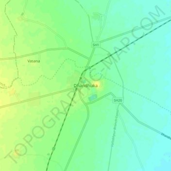
Naam: Topografische kaart Dhandhuka, hoogte, reliëf.
Gemiddelde hoogte: 21 m
Minimale hoogte: 13 m
Maximale hoogte: 30 m