
Topografische kaart Mactan Island
Interactieve kaart
Klik op de kaart om de hoogte weer te geven.
Over deze kaart
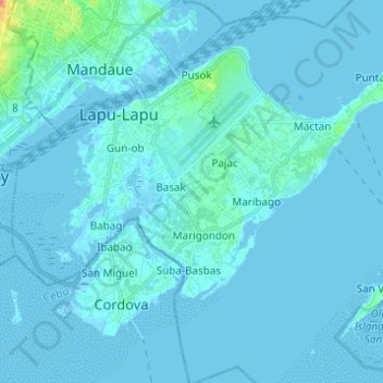
Naam: Topografische kaart Mactan Island, hoogte, reliëf.
Locatie: Mactan Island, Lapu-Lapu, Cebu, Central Visayas, Philippines (10.24964 123.92292 10.33429 124.04565)
Gemiddelde hoogte: 3 m
Minimale hoogte: -4 m
Maximale hoogte: 52 m