
Topografische kaart Lu Verne
Interactieve kaart
Klik op de kaart om de hoogte weer te geven.
Over deze kaart
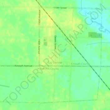
Naam: Topografische kaart Lu Verne, hoogte, reliëf.
Locatie: Lu Verne, Kossuth County, Iowa, United States (42.89909 -94.10494 42.92265 -94.06888)
Gemiddelde hoogte: 351 m
Minimale hoogte: 340 m
Maximale hoogte: 360 m
Andere topografische kaarten
Klik op een kaart om zijn topografie, zijn hoogte en zijn reliëf te bekijken.
Algona
United States > Iowa > Kossuth County
Algona, Kossuth County, Iowa, 50511, United States
Gemiddelde hoogte: 361 m
West Bend
United States > Iowa > Kossuth County > West Bend
West Bend, Kossuth County, Iowa, United States
Gemiddelde hoogte: 360 m
Bancroft
United States > Iowa > Kossuth County
Bancroft, Kossuth County, Iowa, United States
Gemiddelde hoogte: 354 m