
Topografische kaart Drăgănești-Olt
Interactieve kaart
Klik op de kaart om de hoogte weer te geven.
Over deze kaart
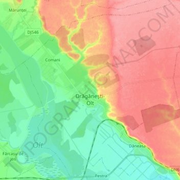
Naam: Topografische kaart Drăgănești-Olt, hoogte, reliëf.
Locatie: Drăgănești-Olt, Olt, Romania (44.12293 24.46656 44.22532 24.61533)
Gemiddelde hoogte: 101 m
Minimale hoogte: 59 m
Maximale hoogte: 148 m
The town is situated on the Wallachian Plain. It lies on the left bank of the river Olt, at an altitude of approximately 100 m (330 ft). It is located in the central part of Olt County, at a distance of 35 km (22 mi) from the county seat, Slatina, and 65 km (40 mi) north of Turnu Măgurele.
Andere topografische kaarten
Klik op een kaart om zijn topografie, zijn hoogte en zijn reliëf te bekijken.